Video summary
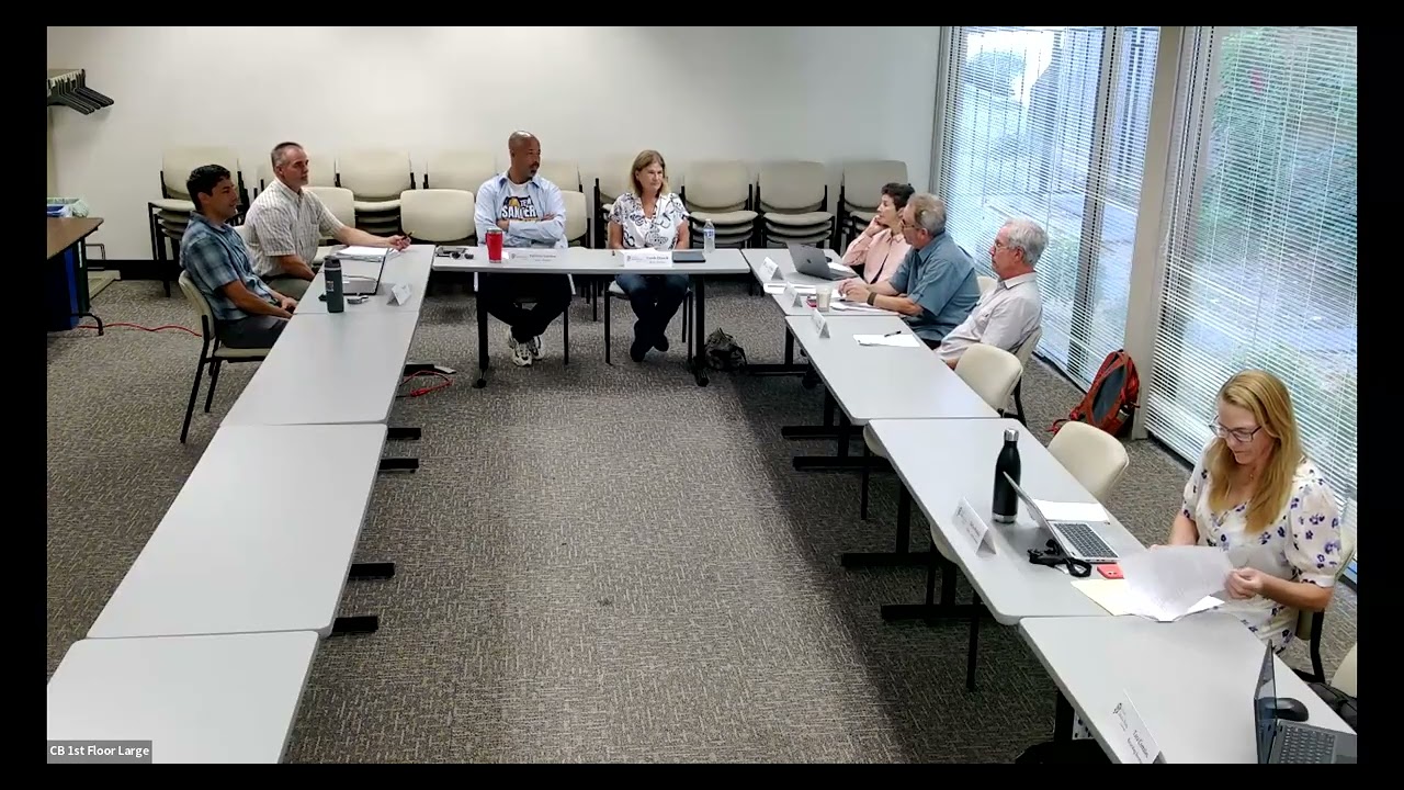
The Waterways Advisory Board meeting focused on several key initiatives regarding creek restoration and community engagement within the city of Santa Rosa. A significant portion of the discussion highlighted ongoing projects with the Water Department, including a successful "Creek Protector Adventure Day" event that engaged children in learning about local ecosystems along Hanner Rosa Creek. Additionally, staff reported progress on Phase Three of the Colgan Creek restoration, which has seen over 10,000 plants installed to create future shade and improve accessibility for residents using strollers or wheelchairs. The department also shared findings from a recent trash reduction pilot study at Sebastian Pole, noting that cigarette butts remain the most prevalent litter item in creeks despite public perception changes. To address these challenges, the city is re-evaluating street conditions to implement targeted cleanup measures and educational outreach, acknowledging the logistical difficulty of treating such vast amounts of stormwater runoff across thousands of outfalls without building numerous new treatment plants.
A major agenda item involved a presentation by Transportation Planner Alexander Segarra on the Greenway Connectivity Study, aimed at bridging the gap between the Southeast Greenway and the Prince Memorial Greenway using federal grant funding. The study proposes three conceptual alternatives to create low-stress connections for pedestrians and cyclists that avoid disturbing creek corridors while enhancing park-like settings along existing streets. These options include routes via Sonoma Avenue, a path through Doyle Park utilizing neighborhood greenways with traffic calming features like speed cushions, or a route directly through the neighborhood on Vallejo Street. The presentation emphasized safety over speed, proposing shared spaces similar to Humboldt Bicycle Boulevard where vehicles and cyclists coexist at reduced speeds facilitated by physical barriers and design elements that discourage high-speed cut-throughs while maintaining emergency vehicle access.
Community input was solicited through an online survey designed to determine which of the proposed alternatives best balances connectivity with neighborhood concerns such as parking availability and traffic flow. The board discussed potential future developments, including a stalled medical center project on Brookwood Avenue, noting that planning must account for long-term growth rather than just current realities. While some members raised questions about specific geometric constraints like narrow spaces between Sonoma and Franquette streets or the maintenance of green strips in new pathways, staff clarified that these are conceptual stages subject to revision based on feedback. The meeting concluded with a strong recommendation for all attendees to complete the survey before its September deadline to ensure diverse community voices shape this vital infrastructure project, which aims to make hidden parts of the city's greenway network more visible and accessible to everyone.
Read the full video transcript
Bosque is it Bosque is
>> It is. Very good.
We don't have anything to report at this
time.
There are certainly a lot of things
going on in the city
as a whole and also planning and
economic development. So I would
encourage everyone to subscribe to city
connections newsletter that gives you a
really great update of everything that
goes on the city
like a 5-minute review highlights and
then you can dig deeper if you'd like.
Thank you.
>> Any questions for Michelle?
I do have one
and
project that's over
What's it called? The Carrillo Adobe
>> Yeah, Creekside.
>> Yeah, so what's the stat where is that
in the process right now?
>> Actually, I'm the project planner for
that project. There has been no formal
development application submittal.
So at this point they've gone through
concept review. They've had a
neighborhood meeting and then we'll wait
to see if they submit a formal
development application.
>> Okay.
>> Right now.
>> So on that note, I go out of my way not
to engage in conversation with so many
people about this project.
>> That's probably a wise idea.
>> And that's the company from San Jose, is
that correct?
>> Yeah, I um I forget their name. It's
been a while since
we've met with them but Swenson.
>> Swenson, exactly. Thank you.
>> Correct. And they've owned it for
probably 20 years ago. Yeah.
Yeah.
>> Yes.
>> But yeah,
um
no activity on it.
>> Okay.
Um
Anything anything to add there? I was
thinking
Yeah.
>> Vic just asked me why I won't engage in
conversation about the Korea Adobe
project. Might you review?
>> Yeah, I think it's probably a a wise
idea. We also as staff members, um
you're representing the city, right? And
you're representing the city as a of the
Waterways Advisory Committee. So, if
you're talking to someone in as a member
of the public who comes to you with
requests, um that may influence any
not that you're taking actions, but
you're reacting to a project that comes
before you through the lens of the
citywide creek master plan, right? Not
through a personal lens as a person
who's um
just living in the community, right? You
have a a guidelines for reviewing that.
So, of course, you can mention
something, oh, this is how we review
projects. We're looking at it through
the lens of citywide creek master plan,
but generally speaking, when people want
to talk to a member of a board or a
committee, they're looking for some
personal reaction to a project and it's
wise just to um
stay neutral.
>> So, I reached out to city attorney
initially.
>> Okay.
>> And she said number one, you can listen
all you want.
>> Mhm.
>> Um but if you engage, you would have to
recuse yourself when it came to this
committee for review. That that's what
she essentially said.
>> Yes.
>> Okay. Well, I think she was advice on
that is just referring to the master
plan.
Um and I like the way you said it, the
lens of the master plan, it's a good
response.
>> Yeah.
>> Okay, will we move on to 6.2
and we have
the water department Steve Brady in
attendance. Um
>> Come on up. You you can pull a chair.
>> Stand here?
>> Yeah.
>> Good morning chairman Haykey and members
of the committee. So, a lot going on in
the creeks as usual. Uh right now our
entire team for me is out. Uh we have a
big event right now. It's called Creek
Protector Adventure Day. So, about 70
children are signed up and this is on
Hanner Rosa Creek along streamside near
Flat Rock Park. Uh
Uh so, they're they are learning about
the plants and animals along the creek,
all kinds of like craft type activities.
Uh so, this is our third year that we've
had this event and we tried to have it
it's like a half day event kind of like
a little summer camp along the creek. Uh
and all kinds of activities. So, that's
going on. We've still
>> Creek Protector
>> Creek Protector Adventure
>> Adventure Day.
>> And that's right now.
>> Literally as we speak right now.
>> right now until 12:00.
>> Wow.
>> So,
>> Cool.
>> Uh and we've been doing a lot out at uh
Cole Colgan Creek with our phase three
creek restoration. We had the ribbon
cutting in late
May May, I think that was the 21st. That
was a great event to celebrate right the
project and highlight everything out
there. We had a great turnout there. I
know chairman Haykey was there among
others and uh
that was great. Uh and we've been
planting out there. So, so far we
planted over 10,000 plants. So, uh way
more planting than all of the other
phases. So,
the trees are small, but it'll take a
couple of years, but I think we'll start
to see uh a lot more trees and shade out
there and it's been great just going out
there. Everyone who comes by is just
saying how great this is. They like to
walk on there now and people with
strollers, wheelchairs, you name it.
Everyone's out there. So,
it's been great.
And then we've been busy with other
creek events. And then once a week we
have
clean up crews, the supervised work
crews from the county
work with us to clean up in common areas
and things like that. So, usually we
clean up about 1,100 cubic yards a year
with all of our clean cleanups. But that
crew probably cleans about 3/4 of the
amount of trash that we clean up within
a year.
So, the other kind of big news and a few
of you have seen it, but Ollie the Otter
is a a mascot now for our creeks team
and has been in a few events. So,
uh
you might see Ollie around and we were
at the Water Smart Expo downtown market.
Uh
That was in June.
So, we were there with a
booth and a great turn turn out. We
actually really focused on trash and
like what are the most common trash
items that we find in our creeks. And we
had a little activity for anyone that
came up to try to
rank the most common trash items that
we clean up. So, that was great. And
what are the cigarette butts are number
one. And and it's actually not from our
team, but from the coastal cleanup each
each year. Cuz when when that happens
you actually keep track of every trash
item.
So,
a few of the people that came up were
just really shocked. They're like, "No
No one I know, you know, smokes
anymore."
There's still a lot out there.
>> Wow.
>> So.
Uh
so that's kind of the big things
happening right now and uh always uh if
there's creek issues that are not uh
emergency, our creeks@srcity.org
is a great email to send your questions
or concerns.
>> Thanks, Steve. Any questions for Steve?
>> I do have one. But you guys do a
fantastic job.
We're lucky to have you and your staff.
Um we had a Friends of the Prince
Memorial Greenway meeting yesterday, 2
days ago.
The topic came up about cleanups of the
pathway and I know that's a little
outside of your jurisdiction. Um but
um there was an event coming. Was it a
marathon or
And the question came up, is there a
cleanup that occurs prior to events that
occur on the Prince Greenway? I always
assumed there was a citywide city
cleanup um before events, but that was
very unclear in the meeting. Do you
happen to know?
>> Usually that that will will happen. A
call will go out to parks and our team,
too, before a big event like a marathon.
>> Okay.
>> So do you do you know when that event
is?
>> 22nd.
>> Okay.
>> My husband thinks he's going to run in
it.
>> Thanks.
>> So I will I will make sure that's on our
list.
Usually there's kind of a call that goes
out that week out.
>> I assumed it was happening. I just was
surprised yesterday or 2 days ago to
hear
maybe it wasn't. I don't know. But thank
you.
>> Yeah.
>> From from the same meeting, um
the murals on Prince Memorial Greenway
are being addressed by um ArtStart. The
city is funding it.
Uh and they're being brought back to
life in a tremendous way and well worth
checking out.
Right down there?
>> Anyone else?
I have a couple things that I ask on.
So, on Colvin Creek restoration, uh
we're on Heron
the city's building a park department
and a library. Is there going to be
northern access and a a pathway for
Colvin Creek through there?
>> There is a plan for that, but uh there
is still one uh private parcel between
Creek parcel and the Heron Hub.
So, that is planned and in the works,
but it hasn't been secured that I know
of quite quite yet, but it is the plan.
>> I see. So,
and then
the funding for the the other portion of
the of the restoration of the park, um
do you guys have funding yet or where we
at with that part?
>> Well, that's our parks uh
department and they did secure an open
space uh grant
>> Oh.
>> for planning and possibly some
construction fund funding, but I think
it will take a little bit of time uh to
go through the park planning the process
and eventually construction, but
>> Okay. Okay, that and then I don't I'm
not sure if this uh
falls under under the water department,
but with the MS4 permit and the trash
reduction,
um there was a pilot study on Sebastian
Pole for
weren't you guys part of that or
>> Yes.
>> How's that going?
>> Well, it
it went well, but what came out of it
was really, you know, with
a tremendous amount of effort, you could
control the trash there, which I don't
think is really feasible to do citywide.
Okay. Uh it did reduce the trash and uh
right now we are doing assessments of
uh a portion of the of the city cuz we
did initial assessments around 2014 or
so about what is the condition of our
streets as far as trash goes. So, we're
re-surveying those. And what will happen
is ones that yeah, there is a lot of
trash, we'll need additional measures
will need to be implemented.
>> Yeah.
>> And and education, outreach, cleanups,
control devices
>> Yeah.
>> potentially. We're kind of concerned
about those though because we have a lot
a lot of leaves and street trees, which
is great, but all those things will get
clogged and actually cause like street
flooding. So, uh we're trying to do a
combination of things, and we can get a
offset credit for trash that we clean up
with our creek side of the team. So,
that's been helpful. We're doing that
anyway, and now we can get credit for
that to count towards removing trash in
our creeks.
>> And I think you probably know this
number, but how many
street drain inlets does the city have?
It's a a whole bunch, and they're not
all the same, are they?
>> Yeah, some are
catch catch basins in the curb or drop
inlets, or some are a combination of of
those. But, with structures, which I
believe counts the manholes, too, I
think it's like 18,000 something.
>> Yeah.
>> So, there's a lot of inlets, and then
even outfalls, like I've heard from
peop- people like, "How come we don't
capture all the water and treat it?"
Well, what I've heard, we would need
like five Laguna treatment plants to
treat that, which isn't really feasible.
But, really the harder issue is our
outfalls are all over the city. They
don't come to one point. So, we have, I
think, on the order of like 1,400
different outfalls.
>> Wow.
>> Wow, that's another challenge.
>> Yeah.
>> I just asked those questions to give the
committee a a sense of the challenges
that are being faced for trash
reduction.
>> Yeah.
>> Okay. Anything else to ask you?
Okay, thank you. Um,
I don't see Sonoma Water here, so
uh we'll move past 6.3 and we'll go to
the scheduled item. Um,
who's going to
be
Is that you?
>> Yeah, Alexander Segarra
here with us today, transportation
planner.
Present.
>> Yeah, Alexander Segarra, I'm the active
transportation planner for the city of
Santa Rosa. I'm here to present on the
Greenway Connectivity Study. Are you
going to be bringing up the slides or
>> Um, I you can share it from your Zoom.
>> From the Zoom. Okay.
>> Yes, then there's a share button.
>> Okay, now I should present or what?
>> Didn't quite get the presenter part.
>> Um,
So, yeah, um I'm here to let you all
know about the Greenway Connectivity
Study. This is an informational item.
Um, just looking for folks to to access
our survey, which I'll have a link at
the the end of this presentation so that
you can give us your
uh input on that um
through the survey. So,
um
the Greenway Connectivity Study is is a
was started through a federal grant. So,
we have a federal grant um
that has been kind of funding this
process.
Um, it is trying to connect the
Southeast Greenway with the Prince
Memorial Greenway. So, if you think
about that, we have, you know, Santa
Rosa Creek there, we have Matanzas
Creek, I think even Spring Creek
potentially that some of these routes go
by, right? All this stuff that we're
going to be doing potentially
will be surface level, so we won't be
touching the creeks at all. It'll all be
on public right away that we currently
have. Um, so yeah, let's let's move on
to
the next slide.
Is that the right one?
Uh, yeah. So,
if you look at this this
depiction here, you got the
the big gap. That's what the circle is.
The gap in between these two greenways,
right? So,
currently, right, we have the Great
Prince Memorial Greenway that connects
all the way to this, you know, along the
Santa Rosa Creek Trail,
um, all the way out to to West
County-ish. And then you also have the
Ridota that connects through there.
There's also the SMART that that does a
really good job of doing a
uh, north-south um,
connection for people walking and biking
trying to get around town using all
different forms of transportation.
Um, so,
you know, we are really appreciating the
fact that there is this Southeast
Greenway that's going to,
you know, be able to connect people to
the outdoors, kind of feel like, you
know, a Central Park in essence, and get
you to all of our favorite parks here. I
know I grew up here. Um, you know, born
and raised.
Um, worked for the city for 18 years.
So, I've seen a lot of different
changes, and this is something that to
me is very, very exciting, right? You
got Howarth Park that it's going to
connect to Spring Lake in Annadel. I
mean, what more could you ask for,
right? Um, hopefully we can make better
connections to the Southeast Greenway,
um,
through other projects as well. So,
like, Farmers Lane extension is a
potential in the future, too,
um, to make that a trail and a path to
to connect to Taylor Mountain as well,
cuz that's a
crown jewel that we have as well, right?
Um,
anyway, back to to this project, which
is trying to create a low-stress
um, connection between the Southeast
Greenway and the Prince Memorial
Greenway.
Um,
we have three different alternatives,
right? Um,
and uh,
and I'll I I guess I can talk about the
goal a little bit just to figure out how
to close this gap, right? And we're
looking for community input on
on that. Um, part of
what we hope to achieve is to have more
of a park-like setting along our streets
as well. So, there is the potential to
add those features as well. Um,
to this so that it doesn't just feel
like, you know, you're going through
roadways the whole way, right? And
hopefully we can create that very
beneficial connection that gets you from
each uh,
each different great Greenway
connection, right?
So, our three alternatives, um,
here's a picture of our three
alternatives on the screen. You got
alternative one, alternative
one goes along Sonoma Avenue, Hamann to
Hoen, and then to the Southeast Greenway
from the Prince Memorial Greenway.
Um, then you got alternative two, that
kind of goes
along Sonoma as well, but then through
Doyle Park, and then uh, along Hoen,
along the Santa Rosa Creek, right? And
then um,
all the way to the Southeast Greenway.
And then alternative three kind of goes
through the neighborhood. Um, so I'll
talk in more detail on all these three
different options
um, as we move along here.
So, um, as you can see, currently once
you get off the Prince Memorial
Greenway,
um,
you know, there's pretty wide walkway,
and now we created this, you know,
class four, they're called class four
protected bike lane. So, you can go
bi-directionally
um, and connect, you know, either to to
Synoma or
um,
to First Street. And so, part of this
connection is try to to to create an all
pitches and abilities connection between
the two parks, uh, the greenways.
Um, so, each alternative kind of runs
along the same course until you get to
Synoma. Then after that, the two first
two alternatives will will head
east and then, um, alternative three,
like I said, is going to be going
through, uh, the neighborhood.
>> Just really quickly, just for
clarification, when you say
bi-directional,
>> Yeah.
>> we're talking about two bike lanes, one
traveling that way and one traveling
that way, or we're talking about one
protected bike lane with two ways of
traffic?
>> So, we have we actually have
both on
that Santa Rosa Avenue connection,
right? So, you have on the the the west
side, it's bi-directional, um, class
four protected bike lane, right? And
then,
on the east side, you also we put in a
protected bike lane going, but that's
just one direction.
>> One direction, got it.
>> Right. Um,
and that was just something we added on
into the project because we we thought
it would be beneficial, right?
>> Thank you. Sorry to interrupt.
>> That's okay. Um,
so, moving on, um,
to alternative two, um, alternative two
runs
right like through These are just
different depictions, but runs through
Doyle Park. Um, Doyle Park is obviously
a pretty amazing park.
Um,
growing up here, you know, I didn't
actually have a lot of access to it
because
uh, I lived on the west side of town and
I didn't necessarily know about that. I
I also didn't even know about Annadel
for the longest time. Um, it's so weird
how you can live in a city and if your
parents don't take you to certain
places, you just don't know what's out
there. So, um I knew about Howarth Park
cuz we always went there, right? Feed
the ducks, all that good stuff.
Um
but yeah, Annandale was something that
came later through soccer. A coach took
me up there and then I started taking
everybody up there kind of thing, right?
Anyway, Doyle Park, beautiful park, I
love it. Um
uh
that would be the connection and then
going along the creek on that Hoena
Avenue path um
all the way up. And trying to make those
connections uh low stress and all ages
and abilities. So, part of that um
the the Doyle Park Hoena Avenue
connection would be, you know, at times
you would have protected bike lanes, but
you could also have it's called a
neighborhood greenway.
Um neighborhood greenways are places
where we like try to slow speeds down by
adding speed cushions, um speed tables,
things like that, or traffic diverters
potentially to divert traffic so it
slows the roadway down and really makes
it safer for all ages and abilities.
Um
if we're doing alternative one, it would
be more of that protected bike lane all
the way down to Harmon Drive. And then
obviously on Vallejo Street alternative
three,
um you'd be going and doing
um
more of the neighborhood greenway type
type uh features with,
you know, speed cushions and some kind
of other traffic calming features.
So, just kind of talking about this more
as you get closer to the connections,
right? Um
you know, along Harmon Drive we actually
have
uh
a project that is going to be part of
our slurry um
that will be adding bike lanes to there
right now and hopefully potentially
slowing down some of the
the the traffic there. Um I know that
currently like I go over there my
daughter has choir, people really speed
through that area. Um I'm like this is a
neighborhood area with a lot of
pedestrian activity going to Montgomery
Village. Think that people would go
slower, too not do. So we're trying to
add bike lanes there to kind of narrow
the the speeds. Um narrow the lanes so
that speeds slow down. Um that's kind of
a
I don't know if you guys have noticed
but a a a progression that we've been
doing is trying to like narrow things
down, slow speeds down by by design. Um
So moving along, this is just a
depiction of what uh Sonoma Avenue could
look like with uh it's called parking
protected bike lanes. So you still have
parking, you wouldn't lose that. You
would have like a median of some sort,
some raised feature, and then the bike
way going along
um the sidewalk, right? So very
protected, very comfortable.
Um
and that would be used in two of the
alternatives, right? And then hopefully
it would be used all the way up to
uh Farmers Lane and then I don't know if
everybody's seen Farmers Lane recently,
right? We have the new bike lanes there
also. That's a traffic calming feature
with bus boarding islands. That's a new
feature for this area. We haven't had
those historically, but other cities
have do done them before and they're
very uh they've been shown to be very
beneficial for people, you know,
boarding buses as well. It gives you
kind of like a little bit more space
when you're trying to get on and people
with wheelchair accessibility issues. Um
And then also being able to
uh ride your bike up and over in a
protected space.
Um it's pretty nice.
I keep telling cyclists and people
walking around there um because I've had
some feedback already. It's a shared
space, right? It's not a place for
for people to go fast. Shared spaces are
where people need to go slow and look
out for each other, right? So, in those
bus boarding islands, obviously, you're
going to have ped and bike conflict.
But, hopefully everybody can share the
space and be accommodating.
So, this is just more depiction of what
like Doyle Park could could look like
with more accessibility
and like creating more of a route
through there for people biking and
obviously there's tons of people already
walking through the park. We have so
many trails along there and so many
connections, right? There's the
connection that goes over the creek
that goes to Vallejo Street, right? So,
imagine being in that neighborhood and
being able to come onto this, you know,
bike way connection slash walking
connection that feels more like a park.
Um, and then also being able to to go up
through Hoening
to the Southeast Greenway.
So,
all this talk and this this is a
depiction of Vallejo Street, so more of
a neighborhood Greenway
type atmosphere. I can as you can see
there's like a speed table there or a
speed cushion
and those are meant to slow traffic
down, calm traffic so that people, you
know, walking and biking,
crossing the street, right? Potentially.
It creates slower speeds and hopefully
safer for folks getting around town. So,
this would be more what the the
connection if you went on alternative
three, how that would look like um,
with traffic calming features. But, I
don't know if you can see the sign. I'm
pretty sure this would be like our
wayfinding. So, you would use wayfinding
to let people know how to get from
Greenway to Greenway.
The wrong way, sorry.
So, yeah. Um
we have a survey out right now. Um
and we're really looking for a lot of
feedback. That's why we're going to a
lot of the different wards. We're
looking for more people to to take the
survey. We have about 500 plus
respondents so far.
Um so, that's pretty good. Um
we've actually been to like Julia Park,
uh planning commission, city council. Um
I think we have
uh
a meeting next next week um on the 29th.
Maybe it's not next week. Maybe it's the
following week on the 29th. Um
but yeah, we have a project web page
here. So, this will take you to the
project web page and then from there you
can find the survey.
Um
so, thank you for your time. I really
appreciate all of you. Um I know it's a
lot of work to to come
to to meetings like this and be on
boards. Uh I plan to do the same thing
when I retire.
Um
cuz I feel like it's
it's a way of giving back to your
community. I I really care about the
community. I understand obviously you
all must too.
So, thanks.
>> Thank you.
>> Yeah. Alexander, could could you
pronounce your last name so everybody
knows how to pronounce it?
>> Yeah, it's Olse Garrett.
>> Olse Garrett, okay. Thank you very much.
It was a great presentation.
>> Yeah.
>> When is the close When is the survey
close out?
>> Uh I believe in September.
Um
>> We got So, we got a little bit of time.
>> Yeah, yeah. We got a little bit of time.
>> Okay. And then what what type of
questions do you want to hear from us
right now?
I mean, I Is it more about the
presentation and the outreach or is it
about the alternatives?
>> Uh I think it's about both, right? Like
so, like I can obviously take your input
now, but like the the easier way for me
is obviously if you go you take the
survey. The more people we get to take
the survey, the more information that we
could log and
kind of decipher through those to see
which alternatives people like the best.
Um, you know, there is the potential
that yeah, maybe people like alternative
two and three, right? And then we might
do like if there's a high number for
both, right? Then
we could potentially do more of them
improvements in all the areas, right?
Um, that's what you know, I guess I'm
not supposed to give my opinion, but
that's what I would like to see it.
So, more improvements the better cuz
like if we can make our streets safer
for everybody and make it easier and
more accessible to walk and bike around
town, like it's only going to, you know,
make our community better, right?
>> So, in the survey did
did you talk about um
did it discuss how much parking will be
lost?
How much parking will be lost?
>> I I don't know if there actually will be
parking lost.
>> Okay.
>> Um, there might be situations where we
could potentially have to remove some
parking, but um
so far
in most of the alternatives, I don't
think that that would be the case. I
think that
we would be able to not have to worry
about removing parking. But if that did
that potentially is in the survey. Um
it's been a while since I've looked
through it, so
um
sorry about that, but um
but yeah, um that would be good input
too is if people are worried about
parking lost.
>> Yeah.
>> Um, I don't I don't think it'll be a
huge amount if we do have to remove
some.
Um, and obviously we will talk to our
community about that when the time comes
if we have to
>> Yeah.
>> make those decisions. I know that's
always a hot topic.
>> Yeah.
>> Um
>> And those decisions will be analyzed
with any alternative, right? When they
when that's preferred. But I I um for
Alexander's presentation,
the best way to participate is the
online survey. You can take your time
with it.
Get all your comments down, and then
they're actually in written form for um
the transportation planning staff to
review, right? And they look at all
those. They
um
quantify all of them and have them all
in a written format, so
that's the best way to participate.
>> I'm looking at survey now. It's a great
survey.
>> It is. It is. And it can take some time
if you want
to be thoughtful about it.
>> Um these are good questions, and I think
sometimes it's helpful because um
and that is why staff is doing this
because often times it is just the
people right around
the particular
park, the greenway, who get involved.
And there are other people who will be
using this, right? It's a connection all
throughout town. So, that's important to
have everyone's feedback.
>> Yeah. We've actually been going to
schools, too, and like the kids have
been giving feedback, and that's always
like the best. It's like going to
schools and interacting with those
folks, you know.
It's uh it's been nice. Um so, I don't
know if all of the schools here like we
went to to Montgomery. I think Trina's
going to go to another one.
Um but yeah.
It's good to get like
like all ages kind of feedback.
>> Sure.
Carol.
>> So, um I ran into Trina uh outside of
City Council Tuesday. She was on her
bicycle,
of course, and she answered my first
question was, "Are these all financially
feasible?" And she said, "Yes, they've
all been looked at." All three of these
are doable.
>> Yeah.
>> Um but I didn't ask her if we could look
at um the Valeo Street neighborhood
slide
Can I liken this to a beautiful version
of Humboldt bicycle Boulevard?
That this is not just a
bicycle lane. This is bikes and cars
sharing
a roadway with slowing speed bumps. Is
that correct?
>> Yeah, so you know, hopefully we would be
able to do more than that. So part of
like Humboldt, right? Is big.
Uh there's different ways to to calm
traffic, right? And so some things are
called traffic diverters, right? So what
you'll do is like say
like vehicle traffic is driving on a
roadway. So
say humble, right? You would put a
diverter so that people
tend to get off of it instead of using
it as a cut through.
Um
>> What's a diverter? I'm sorry.
>> So the diverter usually goes like across
the street so that you as a driver can't
go all the way through, right? So it'd
be like
think about at the end of like a
a cul-de-sac or something like that. You
can't go any further, right? Um
So it'd create that type of feature
potentially. Obviously, we'd have to get
feedback from the community and to make
sure that they're okay with those types
of things.
>> Can you give us an example an existing
sample? I'm thinking
Shanate Humboldt essentially
there's barricades where you cannot
continue on this street. You have to go
the other way. Is that the kind of in
your car?
>> Yeah.
>> by the you know, armory which is
adjacent to the 101. Um
there's a diverter in in like between
the JC not at the JC, but I walk the dog
in this area. So I know the diverters.
There's a diverter in there. So there's
like a little street that you can go
down and instead of being it be to
continue down it, you have to
>> So it's a physical barrier basically.
>> So like it's called Illinois. Illinois
If you go down Illinois, it has this
like
like it's become concrete there, right?
And there was like there is some like
rocks as well. Um
and we actually added a cut through
there so bicyclists could go through
there still.
Um but for the longest time it was just
diverted so people couldn't cut through
there, right? And um I think that
created a better
space for the neighborhood, right? So
like people on either side of the
Illinois people weren't cutting through
as much and then like speeding to try to
get to the light at
um what is it? Like
>> Steel.
>> Yeah, it's Steel Lane.
>> So
how do these diverters play with first
responders
who need to be able to get their rigs
>> Yeah, so there is ways to adjust uh like
wheel pathways, right? Um in other
jurisdictions they've done that. Like we
haven't had to do them here because
there's access usually on both sides,
right? And it it would have to be based
on like, okay, so
fire response or what or
you know
emergency response of any kind, right?
Seeing where at least for fire where
their stations are and see if it will
affect them, right? Um because if you
have and see
if you have like a station on either
side then that that's not going to be an
issue, right? Per se.
But we we would also try to make them in
a manner that you could drive over them
as a first responder kind of
>> Right.
>> Like there's there's ways to design
these things so that it's not completely
closed off to everybody, right? Or you
could add some kind of bollard system so
that they can just pull the bollard kind
of thing.
Um there's there's definitely
workarounds for that.
>> Yeah. There would have to be I would I
would imagine it would have to be
something that and particularly an
engine
>> Yeah.
>> with a wheel clearance
and you do a something like this that
they could drive over that doesn't help
with
police cars necessarily or maybe even an
ambulance.
>> Yeah.
>> Cuz they don't have the same wheel
clearance, right? So, I'd be I'd be
interested to see how that works out.
>> Okay.
>> So, thank you for that clarification.
Going back to Vallejo Street, the
closest thing that I can picture in my
head for this is Humboldt Street, right?
Um, the uh added feature with the um
green strip
looks like we have lost parking there.
Right? And it kind of does a pattern
where you've got parking, you've got
green strips. Um, has it been decided
who'd be in charge of maintaining those
planting areas?
>> I mean
>> So, I'm on the park sport. Is this going
to fall under the parks to to take care
of these lovely spaces?
>> I mean, potentially, right? If if we're
building it out, then it would
potentially fall to the parks.
>> And you guys are the different
departments are in constant
communication with each other about this
stuff.
>> do communicate with each other. I'm not
100% sure if we've reached out to them
yet. Um
but yeah, it would it would probably be
either a parks thing or if it's the
frontage
you know, potentially it could be the
the homeowner, right?
But
>> These things will be looked at. If
there's uh right now these are
conceptual
>> Exactly.
>> alternatives. They're are hey, does this
in general look good? The specifics that
has not been determined or analyzed at
this point. And these concepts, these
alternatives will very likely change to
some degree. But if we have a general
sense of what makes the best connection
that's feasible,
um,
they'll work with that and revise as
needed. I I do have one more question
and that is, um,
we're looking at both today what works
best, but you're also looking at spaces
that may be redeveloped, um, growth,
entire neighborhoods that may go in that
will affect the traffic. I'm thinking
specifically about the Medical Center on
Brookwood which seems to be stalled
indefinitely. If and when that ever
happens, the amount of traffic on Sonoma
Avenue is going to go way up. Is that
you're looking towards the future as you
develop these concepts, not just today's
reality, tomorrow's potential. The city
never seems to stop growing and, um,
it this is something for the next 30, 40
years, not just for tomorrow.
You you are looking at
future
traffic flow, infill structures,
commercialization, neighborhoods,
as well as what works today.
I was I was also thinking about the
baseball games at Doyle Park. Man, are
you going by the ball field?
>> Potentially, like Sheila said, these are
all the finer details that haven't
necessarily been ironed out, but they
will be once a concept is picked, right?
Um, the other thing to think about,
like, so you're talking about traffic
volumes and if we're thinking about how
many people you can get through an area,
um, efficiently, like,
a bike lane can get people up more
efficiently through a whole entire city
than a car lane. A bus A bus lane, like,
a bus specific only traveling, right?
Hey, they can get so many people more
through the city, right? The least
efficient type of transportation is the
car.
Because you don't have as many people
that can fit in there.
And it's, you know, a certain amount of
space, right? Whereas like a bus, right,
is way bigger. And you can hold more
people. So, those are the things you got
to think about in the future if we do
grow
like from like a density standpoint,
like up, like what type of
transportation system's going to be more
beneficial
to get people through. Like we have a
confined amount of space
um already because there's buildings
all over the place, right? That creates
this geometric constraint.
So, we're working within the confines of
that to make things,
you know, better for the future. And I I
believe this is the way, right? Like
this is the way you're going to be able
to get more people in and around town.
>> Right. And I
I think Carol, too, um transportation's
goal is to get people to where they're
going safely,
not to speed them up. That is not their
goal. Um it's to provide alternatives,
um such as these connections, but I
think that's kind of a common
misconception is there's a lot more land
to to be widening roads. There isn't.
Oh, so clarification, I wasn't talking
about speeding anybody up.
>> Great.
>> I was talking about looking towards
future realities as opposed to
ideal situations. Ideally, I would have
either walked or ridden my bicycle this
morning. Hey,
I drove my car.
>> Yeah.
>> Right?
>> So, we
>> not I am part of the problem.
>> So,
>> That's a
>> I One more question and and then we'll
close this off with Steve.
So, um so now I'm avenue is
pretty straight shot down to
close to the Greenway.
And you have it on HoWan turning right
there and going down. And then to get
into the Greenway, you'd go down to
HoWan
park by Montgomery High and then it
would tie in to the very start of the
Greenway.
Um I'm not
speaking of a favorite route or
anything, but there was another idea
that came to me as I was driving down uh
Sonoma and that is the next street over
when you go toward the east past HoWan
is Franquette.
And if you turn right on Franquette, it
becomes a neighborhood street. At the
end of Franquette is a is a creek with a
small narrow bridge over it.
And that takes you then to the other
side of Montgomery High where the ball
field is. The bridge is very narrow.
One day perhaps it could be
replaced with one that would allow bikes
both directions. I'm just suggesting
that as something to think about because
then that avoids the
going on Montgomery High School side and
you know, hooking in that way to the
Greenway. Or maybe it's an additional
possibility. Yeah, you know, cuz we
we can look at a couple different ways
to get between planes
>> two Greenways, right?
>> Absolutely. Greenways. You know, we
don't People Some people go one way,
some go another
uh to get to where they go. So, anyway,
I just thought about that that
Franquette possibility.
>> Well, and I think now that we're talking
about this, it's a great idea, great
suggestion. When you look at these
alternatives and you're taking the
survey, those are things that staff is
looking to hear.
Is there some way as we mentioned, these
are not set in stone. These are kind of
conceptual, but with each plan is there
some tweaking that could be done that
could make it better.
>> So, one of the things is we did look at
Franket potentially already, but the
problem is is the connection between
Sonoma
I mean, on Sonoma between Franket and
Hamman, right? There's not enough
talk about geometric constraints, right?
There's not enough width there to add
any bike lanes of any kind, really.
There's like 4 ft of extra space, I
think.
And it's very minimal. It's something
that really bugs me.
Cuz it's like so many people use that
area to like ride to Howarth Park,
right? Like that's an easy spot to
connect in from
with Sonoma and Summerfield, right?
That's your connection piece just going
straight up.
And that little spot is like the
conflict point to where we seem to not
be able to add in any kind of feature
there.
>> John, I'm assuming routes would all need
to be ADA compliant, so that's going to
add
some width.
>> Alexander, thank you very much um
for the committee.
I'll be asking you at our next meeting
if you guys did the survey. So,
plan on that. Um we I we don't have any
public
here, but I'll I'll again open it up to
public comment. Seeing is there there's
none, we'll close that out. Um I don't
think there's any recommendations that
we need to to do except I recommend
everybody do the survey.
And um
the one thing I do really appreciate
about this is that it's making the
Southeast Greenway better known to the
city because it's it's it's kind of
hidden.
Um all kinds of houses all around. You
always see vacant lots on office
reading. A lot of people don't even
aren't even aware of it. And and this is
uh bringing that awareness. So, this is
where the survey also does that. So,
that's really good.
And then before we adjourn, I just want
to point out we've been
um maybe maybe not we, maybe I been
asking for parking permits so we could
actually do this, but now
First Street is no cost for us. So, um
you can park along here and there's no
cost. So, and indirectly we got what we
what we asked for.
Okay, if there's nothing else then um
we're going to go ahead and adjourn the
meeting. Thank you very much for
everyone's attendance. Thank you. And
thank you thank you again, Alexander.
>> Yeah, thanks.
I guess we're now off record, right?
>> Yes, we well