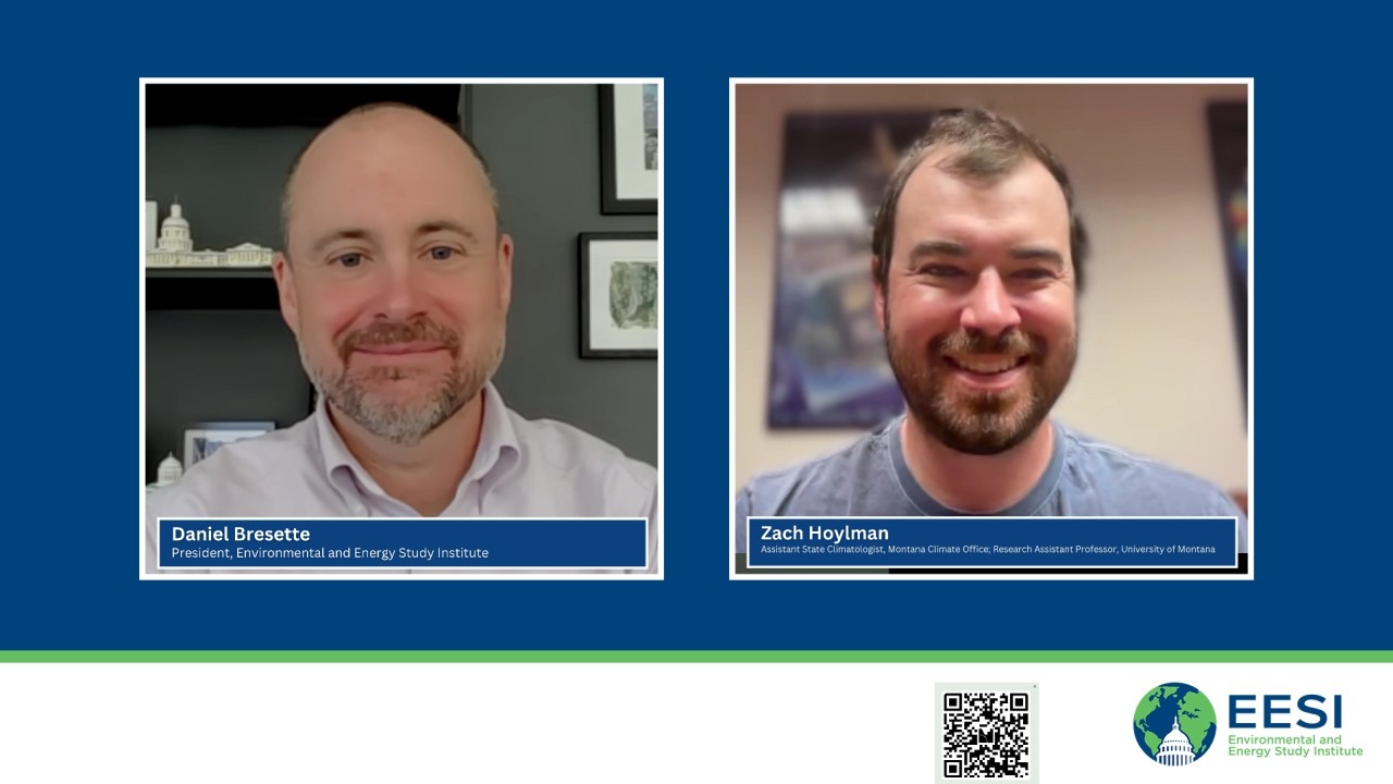
Video summary
The video presents an urgent briefing on the severe drought conditions currently affecting communities across the western United States, emphasizing that these issues extend far beyond dry lawns or wilting vegetation to threaten reservoirs, agriculture, and hydropower generation. The core subject is explained through the concept of the "drought cascade," which illustrates how a lack of precipitation initiates a chain reaction within the hydrological system. This process begins with meteorological drought caused by insufficient rain or snow, but it propagates downward to create deficits in soil moisture that impact agriculture and livestock long after rainfall has returned to normal levels. Eventually, these conditions lead to critically low streamflow and groundwater depletion, creating significant lags where water shortages persist even when weather patterns improve.
The presentation highlights specific data from 2026 showing a massive snow drought across the Rocky Mountains and Sierra Nevada, which set the stage for extreme soil moisture deficits by mid-May and severely reduced streamflows in basins like the Colorado River. Experts note that climate change is expected to make such conditions much more common; projections suggest that events currently considered anomalies could become five times more likely by 2050 and ten times more likely by 2100 under certain emission scenarios. This shift challenges traditional definitions of drought, as what was once an aberration may soon become the new normal, necessitating a proactive approach to disaster preparedness rather than relying solely on reactive measures after damage occurs.
Furthermore, the briefing details how drought acts as a compounding hazard that intensifies other catastrophic events through complex interactions with heat, wildfires, and flooding. Extreme temperatures exacerbate soil moisture loss by increasing atmospheric demand for water, while dry soils become hydrophobic or repel water, leading to increased runoff during heavy rainstorms rather than groundwater recharge. These interconnected risks mean that communities face a "perfect storm" of hazards simultaneously, requiring integrated decision-making tools that combine observational data from snowpack and weather stations with advanced forecasting models to help farmers and resource managers plan for uncertain futures.
To address these growing challenges, the video concludes by identifying critical gaps in federal policy and funding, particularly regarding the long-term maintenance of essential observation networks like Mesonet and SNOTEL. The experts argue that sustaining these data collection systems is paramount because accurate observations are the foundation upon which all drought models and projections rely. Moving forward, there is a strong need for better integration of scientific findings with decision-makers to translate complex hydrological science into actionable support tools, ensuring that nations can build resilience against increasingly frequent and severe climate-related disasters through sustained investment in both operational science and observational infrastructure.
Read the full video transcript
Hi everyone. Welcome to our rapid
readout impacts of severe drought. I'm
Dan Bersette. I'm the president of the
Environmental and Energy Study
Institute. The idea behind a rapid
readout briefing is that if you give us
30 minutes, we will give you what you
need to know about a climate, clean
energy, or environmental topic in the
news. For example, our most recent rapid
readout was a discussion about proposals
to reorganize the US Forest Service. And
before that, we learned about how the
private sector might react to the repeal
of the endangerment finding by the EPA.
Of course, all of our regular briefings
continue. Last week, for example, we
organized a really interesting panel
with our friends at the Natural
Resources Defense Council about a new
research roadmap that could help us
measure and therefore reduce
agricultural nitrous oxide emissions.
And exactly 1 month ago today, on June
24th, uh if you can believe it, EESI and
several hundred of our closest friends
spent the day learning about clean
energy at the 29th annual Congressional
Renewable Energy and Energy Efficiency
Expo and Policy Forum. Visit us online
at eesi.org and subscribe and subscribe
to our bi-weekly newsletter Climate
Change Solutions to keep up with
everything we've got going on. And if
you missed any part of the Expo, you
really need to check it out. It was a
really great show.
Today, we will be joined by an expert
who can help us understand the terrible
drought conditions that so many
communities are suffering from.
Water always flows downhill, as they
say, except when there's no water to
flow. And last winter, areas in the
western United States received less rain
and snow than normal. And now, along
with record high temperatures, there are
serious concerns about an extra-long
wildfire season.
Drought also depletes reservoirs,
which could lead to water shortages this
summer that affect residents,
businesses, agriculture, and hydropower.
And big, big problems that go far, far
beyond dry lawns and wilting trees and
flowers are in our future.
This is also something that we know
Congress is hearing about, and they are
looking for ways that federal policies
can be improved to help states and
communities deal with drought now and
for years to come.
If you have questions for our panelists,
you can send us an email with your
question and the email address to use is
ask, that's a s k at e s i.org. Um, we
really appreciate everyone who asks us
questions and we'll we'll do our best to
incorporate them uh into the discussion.
And while you're watching, uh please
follow us on social media at e s i
online.
So without any further ado, it's my
privilege to introduce our panelists
today. Zack Hoylman is Montana's
assistant state climatologist and a
research assistant professor at the
University of Montana.
Based in the Montana Climate Office,
Zack's work examines how climate change
is reshaping drought, water
availability, and ecosystem processes
across the nation. He combines climate
and hydraulic hydrologic hydrologic
science with remote sensing, geospatial
analysis, and machine learning to
improve stream flow forecasting, soil
moisture modeling, and drought
prediction.
A central focus of Zack's research is
moving beyond the assumption that past
climate conditions reliably represent
the present and developing actionable
information that helps communities,
resource managers, and decision makers
adapt to a changing climate. Zack, thank
you so much for joining us today. I'm
really looking forward to your
presentation.
>> Thank you so much. I really appreciate
the invite to be here.
Yeah, as as uh Daniel said, my name is
Zack Hoylman. Um, I'm really excited to
be here today and I just want to thank
you again for the invite. Um, you know,
I I spend a lot of time thinking about
drought um and thinking about how it
impacts our communities and impacts um
you know, the the places that I
recreate, the places that I love um in
Montana. And so I think this is a really
key topic to be discussing today,
especially under the context of a
changing climate. So today I want to
talk about this concept called the
drought cascade. And the drought cascade
is really um a way to think about how
drought propagates through the water
cycle Um and impacts different
communities, different sectors,
and really I think helps us to
understand how there can be lags in when
precipitation deficits occur and when we
maybe see low stream flow conditions or
low reservoir conditions or see
persistent depletions in our groundwater
systems. And so, this concept of the
drought cascade really helps us to
understand how the hydrological system
um basically interacts with drought as
as a whole. So, next slide, please.
So, what is the drought cascade? Well,
before I get to the drought cascade, the
first thing that we need to understand
when we think about drought is that
drought is by definition an anomaly.
What I mean by that is that drought
isn't necessarily just a dry condition,
it has to be a drier than normal
condition. What this means is that
drought looks very different in
different regions. For example, if we're
in the Pacific Northwest, you may have
10 in or 20 in of precipitation deficit
that then results in a drought. But if
we're in part places like Western
Montana where we only have 13 in of
precipitation over the entire year, a
drought might only be represented by 3
in of a lack of precipitation.
So, that relativity is a really core
concept in drought science. And so, when
we think about how that relativity and
drought kind of dynamics propagate
through the water cycle, this notion of
the drought cascade can be a really nice
conceptual model. So, I'm going to start
this talk by just describing the drought
cascade. We're going to evaluate how
conditions have kind of evolved across
2026 so far this year and then take kind
of a future-looking
perspective to think about what we might
learn from current conditions and
current droughts.
So, the drought cascade can be
conceptualized pretty well by this
graphic. This is an adaptation from a a
hydrological graphic from McNabb which
is from the Illinois State Climate
Office, Water Office, actually, from
from many years ago. But, the top panel,
basically, let's just look at that first
line, shows precipitation and/or
snowpack as your initial drought signal.
Now, this is the key. Drought initiates
by a lack of precipitation or warmer
than normal conditions that cause
evaporation and atmospheric demand, but
it's always starts with generally a
precipitation deficit. So, that top
panel shows that in the first period
where we have a blue shading, we're
actually in a period where we're above
normal in terms of precipitation. This
is just a theoretical location. And then
over time, maybe we have a couple of
months of no precipitation. You can see
that line starts to drift into the
orange box. That orange box represents a
precipitation deficit. So, here, over in
uh say several months, we have a lack of
precipitation, and based on our
meteorological understanding, our
precipitation-based
focused on notion of drought, we're in a
drought. And then maybe over some time,
we have some more precipitation, things
get back to normal, and then we cascade
back into this green area of the of the
plot where we're showing kind of a
meteorological recovery of drought. And
this may be a classical view of drought.
We might think of precipitation as being
one of the key drivers of drought, and
it certainly is. But, we know that
precipitation deficits aren't really
what impact communities. It's deficits
of soil moisture that are impacting
agriculture or livestock production
through hay production, or streamflow
levels that are well below normal that
are impacting municipal water supply or
irrigation water supply. So, what we can
see is as we go down this plot, down to
the next two lines, representing both
soil moisture first, and then
streamflow,
there's this lag between precipitation
deficits and dryness in the atmosphere,
and the response in the soils. And so
this is this drought cascading through
the hydrological reservoirs as we go
deeper into the hydrological system. So
what you can see is that while we might
be responding relatively quickly to that
drought onset, there can be quite a lag
between the recovery of these different
systems and
as they relate to precipitation. So you
can see as precipitation crests back
into that green component of the box and
we're into a more meteorologically wet
period, you can still have persistent
soil moisture deficits or streamflow
deficits that continue long past the
meteorological drought, right? And this
can be taken to the logical extreme with
the deepest hydrological reservoir
groundwater, where you can have a really
long lag between that propagation, that
cascade of that drought signal into the
deeper components of the hydrological
system. So from this slide, what I
really want you to take away is that
drought is not a single condition. It
propagates through the water cycle at
different time scales and the impacts of
drought can really lag behind those
meteorological anomalies. So next slide,
please.
So let's look at what happened this year
in the Western United States. Well, the
drought cascade was quite evident. And
if we start on the left-hand side, what
I'm showing you is three different maps.
Snowpack, soil moisture in the middle
and streamflow. And they're at different
time periods. Snowpack, we're starting
in April 1st, so that's kind of the end
of the snow accumulation series. This is
a typical time period where we evaluate
our snow water resources for the year.
Soil moisture in the middle is in
mid-May. And then at the end is July
15th streamflow. And this is just a few
days ago, um about a week ago, showing
kind of conditions across the Western
United States.
So I've color-coded this based on this
notion of relativity. So you can see
exceptional drought is in those reds and
exceptional wetness is in those blues.
Um but what you can see starting with
snowpack on the left is that you may
have heard the Western United States was
in a significant snow drought this year,
and you can see that here. Especially in
places like the Rocky Mountains, across
Colorado, going through Utah, up into
Montana, big portions of the Sierras and
the Cascades, and really only the
northernmost portions of the Rocky
Mountains were not in a significant snow
drought in this kind of April 1st time
period. So, that kind of sets the stage,
right, for this drought propagation
deeper into the hydrological system, and
serves as an early warning. In April, we
were discussing
concerns about water supplies given
these snowpack conditions. So, now if we
move into the middle, we can see a month
and a half later contributed by these
lack of of precipitation and snowpack,
but exacerbated further by May and April
conditions where we had warm conditions
during those that's those spring months
and lesser than normal precipitation. We
ended up with really extreme soil
moisture deficits. And I chose this May
15th period because, of course, this is
when um there's a a bunch of
agricultural producers that are starting
to initiate their crops. This is when
hay production really kicks off across
our rangelands. Um, and this just shows
that this cascade from our snowpack into
our soil moisture is now having this
lagged impact on our ecological systems
and our agricultural systems going into
May. We can go even further and really
focus in on the Colorado River Basin
area in Colorado, where we had really,
really significant snowpack deficits
alongside these soil moisture deficits,
and see now that this drought cascade
has propagated deep into the
hydrological system, and we're now
seeing extremely low streamflow
conditions in the upper Colorado River
Basin in particular, um which is
contributing to this extreme kind of
water deficit and water crisis that's
occurring in the western United States,
especially in the Colorado River Basin.
So, when we think about the current
drought, this 2026 drought, we can think
about it from the perspective of current
conditions and how they're impacting our
communities, and that's how we should
think about them, and we should consider
all the disaster preparedness and
disaster response that might be required
to mitigate this type of event. But,
it's also important to use this current
event to help us to think about what we
need to prepare for in the future. So,
next slide, please.
So, I was lucky enough to be a part of
National Academies study recently that
just
released this report. I invite you to
look at this report. It's part of a FACA
compliant or a Federal Advisory
Committee Act compliant reporting
process
that describes basically a vision for
future drought assessment and
understanding how to reconcile changes
to our climatic baselines, climate
normals, into the future and what that
means for drought, right? I said at the
beginning of this talk that drought is
by definition a abnormality or a
deviation from normal. But, if normal
itself is changing, then so too do our
definitions of what is drought.
And so, what we know is that the West is
in drought right now. And what we also
know is that climate change is expected
to make these droughts much more common
in the future. So, we can use some
pretty sophisticated probabilistic based
frameworks alongside our latest and
greatest climate projections and models
to really try to understand how current
conditions might be reflected in the
future. So, that's what I'm showing you
here on this map. If you look at just
the top left map, that is current
conditions from June. So, this is June
2026, just looking at precipitation and
temperature anomalies effectively. And
what you can see is that over the
Colorado River Basin, there's this
persistent kind of patch of reds and
oranges, and that represents a
continuation of this of this drought,
right? That's that's been occurring
since
for the last several years, to be frank.
Um and what we did was take those exact
same conditions and then projected them
over the climate from 2050 and 2100. And
so what you can see is that middle top
middle map is 2050 and the top the right
top map is 2100.
And the fact that those colors are
getting less and less red on that map,
especially over the Colorado, indicates
that these conditions are expected to
become much more common into the future.
And in fact, the map two maps below that
are all kind of that salmon red color
really reflect this, and they show how
much more likely this current June event
is into the future. So what you can see
is in 2050, we may expect that these
conditions be five times more likely to
occur, and that's only 20 25 30 years
away. So that's that's actually a pretty
recent time scale in terms of these
really rapid changes. By 2100, we're
looking at maybe a 10 time increase in
the amount of or in the likelihood of
these events occurring, right? And this
is just one climate projection, and this
is just one
emission scenario, a a middle of the
road to middle high kind of emission
scenario, but it really helps us to
reflect how current conditions might be
reflected in the future. And I think
offers us a lens to think about how to
prepare for future droughts by using the
current conditions as an analog for what
we might expect into the future. So I I
urge us as we think about drought in
especially in a changing climate to not
only think about the impacts and current
conditions, but really think about how
we might learn from current conditions
to prepare for the future because a
resilient nation needs to be one that
that really focuses on this preparedness
and kind of shifts from a reactive
paradigm towards a proactive paradigm.
With that, I'll say thank you very much.
Um and here's some contact information
and resources if you're interested and
I'm happy to take any questions. Thank
you.
>> Thank you, Zach. That was a really great
presentation. Um and uh everything that
you just saw and heard is available at
ESI.org or will soon be available at
ESI.org. You can also check out our
YouTube page if you want to go back and
revisit any of the the charts that Zach
just described or or any of or or
re-listen or or re-re-watch the um
uh the briefing. That was a really great
presentation. Um I have a quick
follow-up question. So, I hadn't really
thought of it, but the idea of drought
being an aberration as opposed to normal
condition,
that makes a ton of sense. I'm not a
climatologist, so maybe that's why I
hadn't
thought of it as an aberration, but it's
Is there a debate in sort of the
scientific community about when if
aberrations stop becoming aberrations,
when did they become the new normal?
Uh and so those salmon-y orange charts
that you showed for 2050 and for 2100,
like when does when does unfortunately
this new set of conditions kind of take
over? Is there a Is there like a
scientific consensus about when we kind
of cross that threshold?
>> It's a great question. Um and you know,
this has been the focus of a lot of our
current research is kind of this this
notion of as as baselines are changing,
you know, when do we start to reflect
current conditions um in a different way
to reflect contemporary risk. And that's
really the way I think about it is that
the goal of understanding contemporary
conditions, right, is to describe
accurately to decision-makers,
producers, irrigators, for example, what
their current contemporary risk is in an
accurate way. Because if we are able to
describe to people what their risk is
today, that allows them to understand
kind of how they might modify their
decision-making into tomorrow.
Um so, to answer your question directly,
I would say no. This is um this is a an
active realm of research in drought
science and in climate science.
There's been some really great uh papers
coming out recently
um that have basically used a concept
called the time of emergence, which is
this uh idea basically saying what year
have these are
are what we used to consider drought now
considered the normal condition. Um and
the truth of the matter is that it's
very context-dependent. So, if you're
interested in soil moisture, you're
going to get a different answer than if
you're interested in precipitation or if
you're interested in um you know, snow
pack. But, what is also equally
important to understand is that we have
much greater certainty in certain
components of the hydrological system
than we do with others, right? And how
they're changing over time. For example,
we have much higher confidence in the
trajectory of atmospheric conditions in
terms of temperature, atmospheric
demand, the thirst of the atmosphere for
moisture. We have less certainty in uh
precipitation dynamics going into the
future. So, while I think that there's
still robust debate to be had about when
we might cross thresholds,
we can use the best possible climate
models and the best possible
probabilistic models that we have to try
to think about what we what we can say
uh with some level of certainty about
where we're going, when we might be
crossing these thresholds, and um at the
same time be honest about the
uncertainties that we have in these
systems. For example, I'll just say that
the those maps that I made um are just
for a single climate model. We should be
doing that type of work for all of the
different climate models and seeing
where they all kind of agree or
disagree. It's just an expression of how
we might be thinking about the droughts
of the future,
but certainly more research needs to be
done in that regard.
>> Okay, thanks for that.
As a reminder to our online audience,
we're going to go another 10 or 12
minutes or so. If you have a question
for Zach, send us an email and
the email address to use is ask, that's
or ask that's ask@esi.org.
So you were talking about, you know,
presenting these sorts of findings to
decision-makers and producers.
Our audience, our core audience is
Congress and specifically the member of
the the staff person who works for the
member of Congress. So what are the gaps
that need to be addressed at the federal
level
whether those are funding gaps,
information gaps, or other gaps that I
didn't mention
that we need to be putting more time and
effort into to help alleviate these
conditions. I'm I'm thinking that some
of our audience today will be wondering,
well, what can we do and I'm curious,
what what do you think they can do?
>> Yeah, this is an excellent question and
one that we think a lot about in in the
climate office. And I'd say that, you
know, the biggest gap isn't necessarily
a lack of drought information
necessarily. It's better integration
across scales, better observations,
better translation of science into
decision support, and then of course,
you know, the need for for more basic
science.
I'd say that we've made tremendous
progress in drought monitoring over the
over the past two plus decades with the
origin of the US Drought Monitor and the
National Drought Mitigation ex centers
excellent work on drought dynamics,
right? We've made huge strides in the
preparedness of our nation to understand
drought conditions and respond to them,
right? But I still think there are
important gaps.
The first one is that
you know, all of the models that we
create about drought, all of the
projections that we make, all of the
next generation machine learning based
models of, you know, different
hydrological conditions, etc. All are
fundamentally
um
kind of hinged on the idea that we have
good observations of conditions. And so,
I'd say that the first strong need for
drought um in into the future is
sustained investment in observational
networks. And this goes across different
hydrological reservoirs including NRCS's
SNOTEL snowpack, uh USCRN, the US um
climate reference network soil moisture
observations, streamflow observations
from the USGS, groundwater observations,
and weather stations from both federal
and state level um entities. So, for
example,
um in Montana we run the Montana
Mesonet. This was a um a a large
expansion. It was actually um a part of
a five-state expansion of of the
Mesonet. We're still building it out
right now. That's been funded by the
Army Corps of Engineers. But funding for
that um for that project basically
lapsed at the end of 2027. And so, while
there's oftentimes strong interest to
build out information gathering systems
or these kind of um foundational data
sets, that's is how I think of them, um
these kind of climate grade weather
stations, there's less of an appetite
for the long-term maintenance and
operations, sustaining these stations
into the future. So, I'd say that is
kind of one of the most paramount
components I think to maintaining our
current preparedness and accelerating
our preparedness into the future is
making sure that we sustain and expand
our observational networks across these
kind of regimes. The second I'd say is
better integration of these observations
um
with so that decision makers can
understand the entire water cycle rather
than, you know, individual indicators or
individual drought models. And what I
mean by that is, you know, there's this
shift towards creating tools that are
really co-produced with decision-makers,
whether
um drought assessors or, you know, folks
from industry or risk insurance folks or
all of these different sectors. We need
to create better systems so that we meet
the needs of all of these diverse groups
and we're all speaking the same language
in terms of what we mean by drought and
how how we depict drought. And I'd say
the last thing, third, is that we need
the continued investment in operational
science. Um that that is in the
development of new tools, that's in the
development of creating these
next-generation models that are really
focused on decision-making, that may be
um continued investment in things like
remote sensing and satellite
observations. These are all key
components to a resilient nation in
terms of these kind of disasters and
they really propagate well beyond
drought. They go into many other types
of catastrophes, including wildfire,
floods, etc. So, um you know, that that
continuation of funding and support of
these networks, both observational,
remote sensing, um building of these new
tools to make all of these observations
much more usable um and help directly
with decision-making is just critical.
>> Uh great. Thank you for that. Um
speaking of other catastrophes, um
what's the interplay or what are some of
the inter um what are some of the ways
that drought either affects or is
affected by other severe impacts? The
Those maps that you showed it's a part
of the country that's also dealing with
with flooding, it's also dealing with
wildfires, but also extreme heat. Like a
lot of stuff is hitting communities kind
of all at the same time and how does
drought factor into um how those other
impacts um affect communities?
>> Yeah, it's a great question. And you
know, I'd say
drought is often a
compounding hazard is something the way
that we think about it. Extreme heat, of
course, goes alongside drought. And so
extreme heat and drought reinforce one
another. And you know, when you have
really dry conditions,
there's this this notion in hydrologic
science of sensible heat versus latent
heat. Latent heat is the amount of
energy that's that's absorbed by
evaporation. And when you have less
water, say in the soil for evaporation,
you have more sensible heat, which is
basically the the temperature dial on
your car.
And so when you have less water, there's
just more energy coming down from the
sun and from other sources
that's being translated into heat. So
extreme heat and drought reinforce one
another and can create, you know, these
temperature conditions that are, of
course, extremely hazardous to people.
It can also accelerate things like soil
moisture loss if there is a little bit
of moisture in the soils. Extreme heat
can exacerbate that loss and create
vegetation stress, right? Even if
precipitation hasn't changed that much.
So heat and drought are extremely
interrelated. Of course, when you have
vegetation stress, dry vegetation's low
fuel moisture, prolonged drought
substantially increase wildfire risk,
especially in western forests and
western rangelands. So drought and
wildfire are also quite interrelated.
And that's why when you look at drought
conditions and potential wildfire
outlooks, often times they overlap.
And so we we know those connections
strongly. And
you know, there's there's great work
that shows that precipitation in
particular during the summer time
are these great buffers of wildfire
risk. And so when you have drought and
you have a lack of precipitation during
the summertime, you exacerbate that
risk. Flooding is a really interesting
one, actually, because not only are we
experiencing a more variable climate,
especially in terms of precipitation, we
see quite a bit more um precipitation
variability, big booms, big busts. Um
drought does interact with flooding in
an interesting way. So, when dry when
soils get really, really dry, um they
become what's called hydrophobic. They
They become less less able to absorb
water in some cases. And that's because
water moves slowly through slower
through drier soils than it does through
wetter soils. And this is um a nerdy
relationship um between hydraulic
conductivity and soil moisture. So, when
you have really, really dry soils and
that is interacting with extreme
precipitation events with really, really
high intensities, you can sometimes
produce um reduced um infiltration and
really extreme runoff events. So,
drought what it's kind of paradoxical,
but drought can actually exacerbate
flooding via this feedback between the
ability for soils to actually um
infiltrate that water and recharge
groundwater and instead just discharge
it off of the surface. So,
you know, there's there's many
interactions between drought and other
catastrophes, other hazards, um but
these are just kind of three examples,
heat, wildfire, and flooding that um
kind of show these interrelationships
between these hazards.
>> Yeah, the um hydro soils being
hydrophobic is something if you're into
house plants, you've learned that you
don't want to let your soil get too dry
because then it just it doesn't it
doesn't work that way.
>> Yeah.
>> Um yeah, there's that's really
fascinating. Those runoff events are
really scary. Um when they happen. It
happens very quickly.
>> Absolutely.
>> Um my last question um Zach, before we
let you go, is, um, about forecasting.
So,
um, I'm curious, you know, we've I feel
like we've, um, we've made a lot of
progress and we've covered weather for
advanced weather forecasting in some of
our other briefings and I'm curious if
you have any sort of final thoughts
about sort of the our ability,
um, to forecast drought and how farmers,
in particular,
um, are taking that information and how
that information is being made usable
for them so that they can think, you
know, more more wisely about sort of
what their future plans are and and
maybe what the growing cycle is going to
look like in a in a given place.
>> Yeah, it's a quick great great question.
I'll I'll try to be quick. It's a big
It's a big question. Um,
>> You can take your time. It's okay. We're
doing okay.
>> Um, is incredible. We've We've come
We've come a really long way in terms of
forecasting and, you know, at its core,
forecasting really gives communities
additional time to prepare, whether
that's adjusting reservoir operations,
planning irrigation, allocating water
supplies, or, you know, even preparing
for something like a wildfire season.
And what I'll say is that, of course,
our short-term forecasts out to, you
know, 7 days plus 10 days, um, are
incredibly useful. And they can be
really, really useful, especially for,
you know, we were talking about
agriculture, in particular, for planning
irrigation and understanding kind of the
water demands that might be coming, um,
over the next few days. Um, this is this
is really useful. It It helps us to
understand where we might have extreme
impacts from extreme heat events. We
just had an extreme heat event up in
Montana, where some of our Montana
Mesonet stations were measuring 114,
115° F.
Um, and and that event was predicted
ahead of time. We knew it was coming.
Um, it ended up being extremely severe,
but
that's something that, you know, can
help us to think about how we might
prepare. There might not be much you can
do, but at least you have the
information. You know, but at the same
time forecasts aren't perfect and
particularly when we're thinking about
outlooks that are more like in the
months in advance, they've they've
improved substantially over the last
decade, don't get me wrong, but they do
still present challenges because there
is quite a bit of uncertainty in those.
The atmosphere is an incredibly chaotic
and dynamic system and so being able to
predict what's going to happen in in a
month, 2 months, 3 months becomes
really, really challenging. Um, you
know, and perhaps more importantly,
drought preparedness doesn't rely on
forecast alone. It combines our current
observations, forecasts, and our
underlying understanding of how drought
propagates through the water cycle. So,
like I was saying today, you know, with
this notion of the drought cascade, um,
you might not need a sophisticated
forecast system to tell you that when
you have really extreme snowpack
deficits, etc., that given normal
conditions or drier than normal
conditions, that you might expect this
cascade into other components of the
hydrological system. So, I think that
there's a lot of kind of common sense
forecasting that can occur from these
kind of early indicators of drought like
snowpack in the west and what that might
mean for resulting drought conditions
deeper into the hydrological system like
stream flow. So, you know, forecasting
takes a whole lot of
of flavors and those short-term
forecasts are extremely useful. The
longer forecasts are still useful at the
outlook scale, but need to be taken with
caution given, you know, the
uncertainties. And again, I think that
there's a lot of common sense kind of
forecasting that is already implicit in
a lot of the decisions that farmers and
ranchers are making
when they see something like the lowest
snowpack on record, for example,
in a in a given location and what that
might mean for their stock ponds or
their, you know, creek in their backyard
that they rely on for irrigation. So,
it's a nuanced question, but I hope that
that helps a little bit.
>> Absolutely, that was great. Thank you so
much. Um so, we're a little bit past the
half hour mark, which means it's time to
wrap up. Um Zach, thank you so much for
joining us
today. This was an incredible
presentation and really really
appreciate
you dialing in from Montana to to join
us today. I'm sure our audience enjoys
it as well.
If anyone in our online audience would
like to go back and revisit Zach's
presentation, the slides, materials will
be available at ESI.org. Um you can also
rewatch the live cast or the webcast,
and you can also check us out on
YouTube. The best way to ensure that you
get all of the materials related to the
briefing is to RSVP. So, if you're
thinking about RSVPing for briefing, and
you're like, "Well, I can't actually be
there." RSVP anyway, and that way you'll
get all the materials in case something
comes up and you happen to miss it. Um
but we'll also be publishing some
highlight notes as well.
Um and when you're there, sign up for
climate change solutions. It's really
the best way to keep track of everything
that we're up to. And we've got lots of
other great resources, briefings, fact
sheets, articles, all sorts of good
stuff.
Um if you have a moment to take our
survey, you can use the QR code on the
screen to let us know how today went.
Let us know if you had any audio
problems, video problems, problems with
the webpage. If you have ideas for
future briefings. It only takes a minute
or so to fill out the survey, and we
really appreciate that, and we read
every response. So,
thanks to those who are able
to take a moment to do that. Um before
we wrap up today, I'd just like to say
thanks to everyone behind the scenes at
ESI who made the briefing today
possible. So, thanks to Dan O and to
Allison and to Hannah and to Amory
and to Nicole and Laura and Miguel on
our policy team for pulling everything
together.
We also have Troy, our videographer, who
does all the production.
And so, big thanks to him as well. We
also have two really, really awesome uh
uh, interns uh, with us this semester,
Yasmine and and Megan. Uh, and uh,
they're making great contributions to
our briefings, but also all of our other
resources as well. So, thanks to them.
Um, thanks for joining us. Uh, this is
actually the last ESI briefing until
after Labor Day. Um, but we have some
really, really great articles and other
resources in the pipeline for August.
Um, our newsletter, Climate Change
Solutions, is also taking a break, but
not until after the issue next week. So,
if you subscribe right now, if you're
not subscribing, I'm not sure what to
say, but you really have to subscribe.
It's really great. Subscribe now, you'll
get the issue next Tuesday, and then
we'll be back um, after Labor Day. And
that way you get one more update, a
whole bunch of new resources to give you
some reading material during August
recess. And that way you'll also be
fully in the loop uh, when we get back
in September. So, that's it for today.
Thanks everyone for joining us. Thanks
again to Zach for his great
presentation. Hope everyone has a great
weekend, and we will see you back uh,
online and in person up on the hill for
briefings after Labor Day. And like I
said, well, our our final uh, newsletter
issue of the summer will be on Tuesday.
Thanks everyone. Have a great weekend.
We'll see you next time.