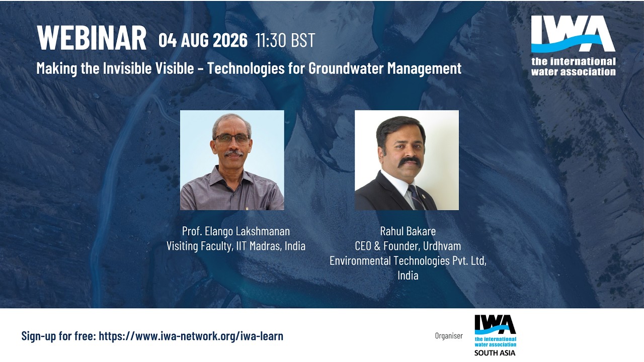
IWA Webinar - Making the Invisible Visible – Technologies for Groundwater Management
Watch on YouTubeVideo summary
The IWA webinar "Making the Invisible Visible" highlighted transformative technologies that bring groundwater assessment into focus, addressing critical challenges such as overexploitation and scarcity affecting millions of wells in India. Professor Ilango Lakshmanan introduced advanced geophysical tools like Electrical Resistivity Methods to map saturation levels and rock types, Ground Penetrating Radar for locating recharge structures up to 25 meters deep, and Surface Nuclear Magnetic Resonance Imaging to distinguish between movable and immovable water molecules. These techniques were complemented by satellite data from GRACE missions to monitor storage changes and Synthetic Aperture Radar to estimate land subsidence in vulnerable regions like Kolkata and Chennai, while GIS integration with AI and machine learning enabled accurate forecasting of groundwater levels and quality parameters such as uranium concentration based on climate variables.
Mr. Rahul Bakri expanded on the practical applications needed to bridge gaps between public awareness, unmanaged demand, and inaccurate source identification by traditional divining methods. He presented innovative solutions including gamified education for visualizing recharge dynamics, a patented "Bore Charger" technology that uses inter-aquifer transfers to artificially inject rainwater into deep borewells significantly increasing yield within seconds rather than relying on natural processes over millennia, and Vertical Electrical Sounding to scientifically locate optimal sites for wells. Furthermore, IoT-enabled monitoring systems like the Jester project provide real-time predictive analysis of water levels, empowering farmers with data-driven decisions on cropping varieties, while sustainable urban drainage systems such as bio-swales allow flash flood waters to be screened and recharged in situ without oversimplified ditch-based approaches that could lead to financial loss.
The discussion also clarified technical nuances regarding risk assessment and data requirements, noting that low resistivity zones do not automatically indicate aquifers but may signify clay formations or seawater intrusion requiring test boreholes for verification. Experts emphasized that while sophisticated instruments are valuable, simple field observations of surface formations often suffice for shallow unconfined aquifers, whereas deeper investigations necessitate basic instrumentation like VES rather than costly oil-field-grade equipment unless essential. Additionally, the session addressed sinkhole risks by distinguishing between slow subsidence and sudden collapses caused by drainage failures or limestone issues, stressing that accurate spatial risk evaluation requires geological tools to assess subsurface strength alongside slope changes and rainfall patterns.
In conclusion, the webinar underscored the importance of scaling these solutions through local capacity building, specifically training youth as para-hydrogeologists for data collection via IoT networks to foster affordable and sustainable services. The event highlighted successful implementations such as over 6,000 uses of boat chargers in volcanic basalt regions extending hand pump yields from winter to summer months, reinforcing the need for professional hydrogeological assessments before constructing recharge structures to avoid ineffective investments. Looking ahead, IWA announced upcoming events including sessions on indigenous women water stewards and nature-based solutions, alongside major gatherings like the World Water Congress in Glasgow and the Digital Water Summit in Istanbul, offering non-members a discount to encourage broader participation in these vital discussions on environmental sustainability and livelihood support.
Read the full video transcript
Good afternoon, good evening and good
morning to all the participants who have
joined uh us today in the webinar titled
making the invisible visible
technologies for groundwater management.
Uh myself Afia Siddiki from IWA and I'll
be moderating the session today. Next
slide.
So just a few housekeeping rules for our
participants today. This webinar will be
recorded and it will be made available
on demand on the IWA website as well as
the IWA member exclusive connector
platform. And the speakers are
responsible for securing their own
copyright permission and any opinions,
hypothesis, conclusions or
recommendations contained in the webinar
are the sole responsibility of the
speaker and do not necessarily reflect
IWA opinion. Next slide.
So for all our participants today we I
would encourage them to uh introduce
themselves in the Q& in the chat box and
you know to have any questions general
questions and for uh questions related
to the panelist and the speakers I would
like you to post it on the Q&A box only.
Next slide. So quickly going through the
agenda for today. So I'll do start with
welcoming the participants and the
speakers and introducing the webinar.
Then we have two exceptional speakers,
experienced speakers uh professor and
Mr. Rahul uh who will each be presenting
their own uh case studies and which will
be then followed by the panel discussion
and Q&A and then with the closing
ceremony. Next slide. So just to give a
brief brief background of today's
webinar. So this webinar is part of our
series which is groundwater the
invisible lifeline which aims at
understanding how groundwater is
perceived from an unseen extractive
resource to a dynamic living system. And
this today's webinar is the third
session which will focus specifically
focus on the technologies and innovation
that are transforming groundwater
assessment monitoring mapping and
decision making. Both the speakers will
share their own experiences from both
the theoretical and practical experience
and point of view. Next slide.
So without further ado, I would like to
now welcome our both the speakers. So
our first speaker is professor Ilango
Lakshmaran who is a visiting faculty at
Indian Institute of Technology Madras,
India. So uh professor Ilango has over
38 years of experience in hydrogeeology.
He's currently a full-time visiting
faculty uh at IIT. He and he has also
served as a vice president of
international association of
hydraological sciences from 2015 and
2019 and also the president of IIH's
international commission of water
quality. Our second speaker is Mr. Rahul
Bakri. He's the CEO and founder of Utam
Environmental Technologies based out of
India. to uh uh Pune, India. By
education, he has done his MS in
mechanical engineering from Michigan
State and has done his executive MBA at
IIM. And he has worked for around 14
years in software and IT and he has
in-depth experience in project
management, product and people
management and PRP, CRM etc. So uh
without further ado, I would like to now
invite our first speaker, Professor
Ilam. The floor is yours.
Hello to everyone.
Hope my screen is visible and it is in
presentation mode.
>> Uh yes sir, it's visible.
>> All right.
>> Uh can you put it in slideshow? Yeah.
>> Is it there on slideshow now?
>> Yes. Yes. Thank you.
>> Hello to everyone. Thanks for the nice
introduction. I'll share basically out
of uh several works which we did. I just
picked up a few for presentation today.
How can we make the invisible
groundwater visible? So there are
several tools. Some of the tools I'm
listing it here. Basically geophysical
exploration methods help us to
understand where the groundwater is.
Though we don't see with our eye, we
make use of certain techniques to
understand where is it located. Is it
viable to tap yeah an acryifer system
with limited amount of groundwater? All
this can be answered using geohysical
tools. Right? One of the most important
tool is the electrical resistivity
method in which what we do is we are
going to apply current. As you can see
in this uh picture on the right hand
side bottom right we apply current
between two points and the effect of
that is steady in between the two. That
means we apply current we measure the
potential. As we increase the distance
between the electrodes, we are able to
we are able to understand greater depth
of the subsurface. Right? That means as
you increase the distance, we are able
to increase the depth of penetration of
current. So this is how we are able to
understand whether the formation is
saturated, whether it is a clay
formation or sandy formation where the
water table is. Right? So here is an
example right wherein we are able to
understand the spatial variation in a
cross-section and the electrical
resistivity values that mean the
horizontal line is the surface ground
surface this is the ground surface what
you see here is vertically below your
long profile. So in your profile we have
now come out with the variation in the
spatial variation in your vertical
section with reference to the electrical
resistivity with the scale given at the
bottom. Right? So what we are able to
get from here though the water is
invisible. We are standing on the
surface but we are able to clearly
demarcate a zone which is having very
high amount of salinity because blue
color as you can see here is the zone
which is having the lowest resistivity
in this section. Right? Whereas this
section has got high resistivity
probably they are devoid of any
groundwater most likely they are hard
rock formation. So this is how we are
able to see what is present below the
surface of the earth using electrical
resistivity method. Then the other tools
are ground penetrating radar which is
often used to study the shallow
subsurface.
Here are the two case studies in which
we deployed this ground penetration
radar tool to understand the subsurface
beneath a river bed. Right? What you see
is a river. The river flows this way.
Right? wherein there was a check dam to
be constructed to mitigate the issue of
seawater intrusion just north of the
city of Chennai before the commencement
of the site selection itself we did
several traverses to understand the
location where we don't have any
confining layer very close to the river
bed that means so only then yeah
recharge structure will perform better
for that we had deployed ground
penetrating radar right similarly at
another
a need for improving the groundwater
quality since it had got it has
completely saligned sea saline seawater
wherein a percolation pond with a shaft
was tried to identify a suitable site
ground penetrating radar can be a ideal
tool to understand the subsurface
characteristics. The limitation however
is it cannot go beyond 25 m below the
surface below ground surface. So this is
ideal tool for locating recharge
structures. Another major tool which is
very popular since last one decade which
is surface nuclear magnetic resonance
imaging. In this method a magnetic field
is generated using a transmitter.
The effect of transmission leads to
change in the way in which the protons
are oriented in beneath the surface of
the earth due to the external mag
external magnetic field.
As and when we stop the application of
the magnetic field these protons realign
themselves according to the earth's
magnetic field. So during realignment it
produces some signal that signal is
measured in using this surface nuclear
magnetic resonance imaging. The greatest
advantage is these protons are present
only in mostly in water present water
present below the surface of the earth.
Hence indirectly we make the groundwater
which is invisible visible using the
surface nuclear magnetic resonance
imaging. In fact this is the only method
which directly help us to identify where
the groundwater is below the surface of
the earth. There are several techniques
right that means we measure the data by
varying the generation of magnetic field
over the surface of the earth and study
the response of that and we can also do
what is known as a inversion technique
wherein we assume certain subsurface
model for that we produce the signal
then we measure with the we compare the
measured data by doing so and there is
also an option to understand about the
water content present below the surface
of the earth. Due to the fact that the
water molecules are able to move freely
in zones where the porocity is
considerably moderate. That means if you
take a sandy formation, the water is
able to move very freely. Though
porocity is high for clay formations
wherein water is held so tightly wherein
they won't be able to spin as I have
indicated in this diagram. Hence with
the help of this we are able to
demarcate which zone has got movable
water which zone has got immovable
groundwater. That is the advantage of
this particular tool. So these are all
some of the important geohysical tools
that help us to understand the
subsurface. Today we are heavily
dependent on satellites for everything.
Right? One such tool is the grace
mission since the year 2002. We have
this two satellites going around the
earth in the polar orbit that help us to
understand whether the whether there is
any gain or loss of groundwater on the
surface of the earth. There is also
another set of satellites which are
sending radar waves. Right? These radar
waves
touch the surface of the earth and then
they get reflected or refracted back
using which we are able to understand
the elevation difference whether there
is any land substance. These two data
can be synthesized to understand whether
or withdrawal of groundwater is causing
land subsidance. So these tools are now
available right especially grace data is
free whereas sentinel data we have to
pay and get the uh information right
here we have made use of grace data to
understand how efficiently it is able to
predict the groundwater head in and
around Chennai region. So what we have
plotted both the measured groundwater
level along with the grace derived
groundwater storage there seems to be
very nice correlation. Similarly with
respect to time here you can see the
blue line is the blue
that is gravity measurement that is
grace derived value and the red is the
measured groundwater level. There seems
to be a reasonable comparison except for
certain years towards later which is
attributed to seawater intrusion. Right?
Similarly,
land subsidence I as I told you
previously can be estimated using
synthetic aperture radar satellites.
Here there is a tool called SRscape.
This tool help us to understand the land
deformation. Since the satellite goes
over the same site at least on a once in
a month's time. Suppose if you take a
data after a gap of 2 3 years we will be
able to know whether the land surface
has deformed whether it has emerged or
whether it has whether it has witnessed
subsidance. Right? Here is an example
from Kolkata city wherein you can see it
shows the land surface is going down
with respect to time. This is a bit old
study from 2003 to 2010. We carried out
this study uh using the data from 2003
to 2010 that corresponds very well with
the measured decline in pometric head.
So here too the white lines here
indicate the pometric surface which is
the lowest here where we have witnessed
highest amount of land substance. So
here is this is another tool to rapidly
understand the variation in the land
surface
ge geographical information system right
uh using any of the tools here we have
used this particular tool to understand
the variation the variation in the
groundwater recharge potential zones or
southern India right in which we had
used AHP technique which is nothing but
a multiriteria decision making wherein
we fix up your goal that mean the goal
here in this case is differentiate the
entire southern India into highly
potential moderately potential poor and
very poor for recharge right so by
assigning different criterias for
example geology soil slope and so on we
can come out with different alternatives
so using this tool we had identified
groundwater recharge potential zone for
entire southern India. Over there we had
the novelty of this study is over there
we had also identified groundwater
recharge potential as well as
groundwater potential zones right. So we
need to integrate this right whenever we
plan for any new managed aer recharge
structures we need to identify poor
groundwater potential area wherein
recharge potential is very high. This is
another tool using the same multiriteria
decision making tool. We had selected
ideal sites for recharging groundwater
in Bangaluru city. More than around
10,000 such recharge wells were
constructed in Bangalore city making use
of the same technique. So we could also
get a visible improvement in groundwater
level as and when we completed the
construction of these 10,000 recharge
wells.
There are several tools that require uh
for groundwater monitoring we use
several tools in one of our case study
involving construction of a percolation
pond which I had indicated previously
wherein we did ground penetrating radar.
A percolation pond was constructed to
improve the groundwater quality for
supplying water to a small rural
community living there. The entire area
is highly salonized due to proximity of
the proximity of this side to the sea as
well as the backwaters right wherein we
constructed a percolation pond. In order
to understand the efficacy of this
speculation, we had also drilled four
pometers adjacent to that and these were
heavy instrumented using several
advanced automatic sorry automatic
weather station and also multi multiple
probes to understand the groundwater
potential in the pond as well as a
nearby well in all the pometers. Right?
So here this research was published as a
part of this book published by IWA.
Those who are interested can have a look
into this for more details. And one of
the common problem which we face
especially after severe rainfall right
even suddenly the ground surface gets
flooded
right and the water table is somewhere
here. This is the groundwater table. But
the ground surface gets flooded and
leaving lot of air entrapped between the
saturated or flooded surface as well as
the saturated zone. Due to the presence
of these air bubbles, water is unable to
get infiltrated into the groundwater.
Though we had plenty of flood waters at
the surface, they are not really
benefiting groundwater recharge due to
the entrapment of air. We thought of how
about providing a small tubes in the
unsaturated zone so that when during
floods the air which got entrapped due
to the pressure of flood water may
escape through this. So this concept was
presented to the ministry of science and
technology. They funded a project. So we
did several experiments in some sand
tanks as you see here with some moisture
sensors kept at frequent uh distance
from the surface. Right? And we had also
put a automatic water level recorder to
study the effect of this flooding. Then
we we had also carried out some field
experiments. The experiments support
that the presence of vent for example
this is one two three and so on help to
quickly recharge the groundwater. This
technique is able to overcome the
problem of entrapment of air. Right? We
had also filed a patent of this to this
technique. Then coming to artificial
intelligence and machine learning in
groundwater.
There are number of researchers who have
very efficiently used AI and ML tools
especially for predicting groundwater
level as well as groundwater quality and
groundwater recharge. Right? So these
are all the popular um
themes in which people have applied the
application of artificial intelligence
as well as machine learning. Most of the
researchers have used these tools to
achieve their objectives. Right? I I'm
just presenting two examples. In one
example carried out in Germany, the
authors have
put into use of machine learning to come
out with forecasting of groundwater
level. So they have achieved a
reasonably nice results with nearly 17
monitoring wells they had but they had a
long-term data from 1967
to 2015 and they considered three
important variables. One is temperature,
precipitation as well as humidity.
They had made use of three different
machine learning or AI models and
reasonably all the three performed well
whereas this one achieved very highest
amount of NSC as well as squared. CNN is
also not very much lagging behind. So
these tools nowadays are becoming very
popular to predict groundwater level. As
you can see here right both observed as
well as predicted
especially by knocks they are more or
less going over each other right and
here is the performance of the model. So
the key finding is though all the models
performed reasonably well this model
seems to be outperform the other two
whereas CNN is also able to give a
reasonable kind of results and we had
also used something similar to what we
had seen previously to predict
groundwater quality in one part of India
in Karnataka right wherein we have been
collecting groundwater samples once in 3
months for a period of about 4 years
from over 50 wells for which we had
applied
machine learning coupled with ant colony
optimization tool as you can see here
let us not go into depth this is
published in this uh details are
available in the paper which I'm giving
at the bottom right what is interesting
is we use nearly 70% of our data for
draining then the Rest of the data was
used to test the results of the model.
Since we had observed the groundwater
quality with regard to major ions over
50 wells every well we had we had
measured about 10 parameters such as
sodium chloride potassium. I'm just
showing you the results of couple of
them right in one particular well I'm
showing similarly we have results of 50
wells. You can see reasonably the the
orange color line or the saffron color
line is the model predicted and the blue
is the measured value. There is a
reasonable comparison between both and
also here I'm showing you for uranium
concentration which is very important.
So there is a reasonable comparison
between the model predicted as well as
the observed value. Then we also checked
whether 50 at 50 wells 50 different
models predicted the concentration and
then we came out with a inverse distance
method to extrapolate the concentration
over the entire area. Then we compared
that this left hand side green one is
observed and the right hand side is the
model pred predicted there is a
reasonable comparison. So these models
are able to very nicely predict the
groundwater quality. It though we are
using several other contaminant
transport models. This machine learning
tool seems to be a very good way to
estimate the groundwater quality. There
are also several other ge digital tools.
One such tool is a popular tool is the
water evaluation and planning tool which
we deployed for the city of Chennai to
understand to forecast the unmet demand
in water supply right considering the
expected population growth in future
right if according to the estimated
population growth suppose the demand if
it increases using this tool by
considering different sources we'll be
able to forecast the unmet demand
demand. So here is the demand unmet
demand right on the y-axis you have the
unmet demand and the x-axis is the time
axis right time axis and we played with
the model by considering different
rainfall patterns. Suppose if you have
excess rainfall every year suppose if
you have normal rainfall every year if
you have deficit rainfall how will the
how much will be the unmet demand?
Suppose if you put forth of used water,
let us assume 200 ml of used water is
put into the supply chain, how we'll be
able to meet the unmet demand. Details
are available in this uh paper. So this
is how deep model can be used and of
course groundwater models are excellent
tools to forecast
or run scenario analysis of different
including engineering solutions. In this
case, as I had told you previously, 15
check dams were constructed across these
river basins located just north of the
city of Chennai. Even before the
commencement of construction of these
check dams, we estimated the possible
impact of these check dams in this area
using this numerical model. Then we had
also run the model to forecast different
climate change scenarios. So what you
see here is the impact of this right. To
conclude, we are currently working on a
major digital twin. Digital twin is
nothing but replicating what exist in
nature into a computerbased system with
realtime analysis and also people's
participation right wherein we are
coupling several models. It is a
collaborative project between India and
Delft. That is it. Thank you very much
for your attention.
Uh thank you so much professor Elango
for that uh you know detailed
description about the tools and the
models that we can use uh you know for
groundwater uh mapping and assessment.
So thank you thank you so much for
sharing your insights and we will take
up the questions in the uh panel
discussion. So now I would like to
invite our next speaker Mr. Rahul Bapri
to discuss more about his work in the uh
in technologies and innovation and
groundwater. So over to you sir. Thank
you.
>> Yeah thank thanks for this opportunity
Afia and welcome all uh to this uh
webinar. Um I'll quickly share my
presentation. I hope it is full screen.
>> Oh yes sir. Yes.
>> Yeah. So uh the topic given to us is
basically making the invisible visible
the technologies for groundwater
management. Um I would like to go
through various uh types of uh uh
problems various types of issues uh
faced by groundwater and I would like to
discuss on practically what and all we
do to basically uh give solutions to the
problems what we are facing. So for
example India is the largest user of
groundwater. It has around 8 8 crore
that is 80 million existing bore wells
and open wells and through that we are
overexloiting groundwater to a great
extent so much so that farmers are
committing suicide women have to walk
far away places even water has to be
applied through tankers and water
quality is becoming a major issue in
some cases uranium chromium has started
coming in groundwater as such so
groundwater in the Indian context is one
of the major water sources 80% of India
depends on groundwater as such and uh
this is problem what we are we are
facing. So
when we mapped the water utilization
flow we realized that basically there is
something called as natural resource and
the source needs to be developed treated
then basically it's used and waste water
is generated and waste water is treated
uh and that is something which is the
the the kind of water utilization flow
and from source development to waste
treatment uh is there a lot of crowded
engineering product space. So we provide
solutions to the sustainability of the
natural resource may be groundwater,
surface water or rainwater and we use
lot of IT, IoT, robotics, mobile
technology to solve the people's problem
on the ground as such. So why we need to
think about groundwater? Because
groundwater is invisible. It is unseen
hence understood, unappreciated. Uh but
it is creating tremendous amounts of
problems and that's why we should learn
about groundwater. Water, water because
of water, groundwater basically droughts
and desertification is happening all
across the world. As such, groundwater
also is one of the the reason why
deforestation is happen. So a lot of
forestation is also happening because of
climate change the recharge regimes are
changed and because of the recharge
regime because of the change in the uh
basically rainfall patterns intensity
etc. uh it's also creating lot of
deforestation and as I said the droughts
as a matter of fact desertification and
earth forestation is a solution for that
but currently the earth forestation
doesn't take into account the
groundwater regimes as a matter of fact
and actually that is something which uh
people certainly should know where to uh
uh plant which kinds of trees depending
on the hydrogeeology part of it right
typically based only on the clim
aggroclimatic zones the uh forestation
is done. But probably for the plants to
uh basically leave, sustain and move on
and and grow
one needs to understand groundwater
hydrogel. Rivers are drying up as we
know it. Uh many places rivers flow only
during the rainy season as a matter of
fact and during the non-raining season
there is no water because the base flows
have dried up. And why the base flows
have dried up? Because water in the
unconfined aquifers uh in many parts is
used for pumping at a much uh faster
rate than what nature can replenish and
because of that the base flows are
reducing and because of that rivers post
monsoon are not providing any water to
the civilizations as such. Water also is
a major problem because when we
construct a roll when we when we create
a escarment that creates a a weak zone
for the hydrostatic pressure to get
applied and that's what creates the
landslides. Landslides also are caused
because of the friction between the the
the the w between between the different
particles and the pebbles and stones uh
gets reduced because of too much of
water uh uh basically getting seeped
into location. So unfortunately many
such uh construction activities maybe
houses may be roads maybe even watershed
kind of uh uh treatments are done
without any understanding of hydro
geology that creates more problems than
solving the problems as such. We have
seen uh in in in my uh near my city
village which was entirely swiped away
by by by by a landslide because
unfortunately without understanding the
hydrogelology a huge tank was
constructed upstream uh which was a farm
pond and that farm pond during a very
torrential rain evening basically
succumb to the uh uh to the water and
basically that water created tremendous
amount of I would say force on the
slopes and basically the entire village
was flooded and entire village village
was actually buried under the mud but
because people didn't understand the
hydro geology when they considered
constructing that farm pond in that
location um at the same time we also
have seen many places sink holes happen
as we know sink holes also happen
because of not understanding the
underground water regimes uh which are
out there and because of that many
places a lot of uh basically destruction
happens. Uh water also groundwater also
is a is a problem which causes
foundations to fail or foundations to
topple over and hence the households
also kind of topple over. uh land
subsidance is another major issue which
is faced by many people in Califura
context uh 9 m subsidance is seen in
some places there's a tremendous amount
of subsidance creating tremendous amount
of problems to groundwater assets so
what I'm trying to say is that again
these are the basements which are
flooded during every rainy season in uh
uh in in India uh because again hydrog
taken into consideration while
constructing those basements as such so
hydrogen
critical and crucial
But unfortunately it is not taken into
consideration. It is taken certainly
into consideration while mining but
there also in many places flooding of
the uh uh shafts and mining uh shafts is
already seen as a matter of fact. And
lastly, groundwater also needs to be
considered while developing the
sanitation uh infrastructure because uh
in the in the in the Indian context for
example, pit type recharge systems pit
type uh uh toilet construction creates
tremendous amount of problem in the
rainy season because lot of that water
uh becomes groundwater and gets
transported downstream. So for even
something as simple and as distant as
sanitation also needs to take into
consideration the hydro geology as such.
So there are three major gaps in
groundwater motor domain. What we have
seen uh first of all awareness and
education in general masses doesn't
exist. People don't know they have very
imagination about groundwater motor
whether is there any stream flowing
underground or there's a pond or there
is a sea of sweet water but nothing of
that sort exists but unfortunately
people have that kind of a
visualization. Second is that people
want more and more supply for their
day-to-day activities and their economic
activities as well and people want more
and more water. Uh and whatever water
which is generated uh uh through
groundwater supply uh it is not managed
properly. So the demand management also
needs to happen because lot of water is
given to plants especially in
agriculture in uh basically in in furrow
and and and that kind of a way. uh and
because of that uh a lot of water goes
gets lost in the uh evaporative losses
as such. So we work in awareness and
education as I said awareness education
is a very important part of it. We have
developed a gamified visualization for
education and awareness generation on
groundwater motor behavior because as I
said uh giving people animations people
are not able to imagine. So we have
developed this see-through uh model of
uh groundwater behavior on which kids or
even adults can basically put uh rain on
top of it and how the groundwater
behavior happens. It can be simulated
through gamification of education kind
of a methodology where uh difficult to
visualize 17 to 18 scenarios they can
generate by themselves through play and
by that they are able to understand the
uh groundwater behavior. So because it
is gamified there is a better retention
of this uh understanding in their brain
and longtime recall happens. So that's
what we have seen and observed in the
Indian context. As such we also work on
supply augmentation. Uh we have
developed a patented smart motor
technology that recharges and revives
existing low yielding or dry or wells uh
in which we uh basically do
interacquifer transfers uh obviously
with due scientific understanding. So
when the rainfall happens the topmost
part of the system there is an animation
uh gets filled up very quickly but
through different hard rock layers for
the water to reach up to 200 ft for
example it takes hundreds and thousands
of years and from there to reach up to
let's say 600 ft takes millions of
years. So is the slow nature of
groundwater recharge as a matter of
time. But when we drill a bore well, a
drill is the driller makes one hole up
to let's say our board is 600 ft within
one day. And what we see borewell on the
surface actually is a casing pipe which
is impervious PVC MS steel pipe and that
doesn't allow any debris to fall in the
bore well. But along with that
replenishable water from the topmost
aquifer also doesn't enter the bore
wells. So bore wells typically get water
from the lower aquifers whose u natural
recharge is very low and slow but our
electro mechanical pumping is very fast
and because of this imbalance typically
initially good yielding bore well slowly
become seasonal and many of them they go
dry completely. So in bore charger
technology our trained hydro geologist
undertake angography of the bore well
and we uh put our patented tool uh after
in the bore well and we perforate that
casing pipe at hydro geologically
appropriate depth so that only filter
water will come in the bore well and it
artificially gets injected in this bore
well and it reaches 600 ft within few
seconds but it takes millions of years
and it gets readily stored in those uh
uh greater depths. So this is kind of a
vertical uh smart rainwater harvesting
uh technique what we have been able to
develop and we have implemented more
than 7,000 u well recharges and uh we
have seen tremendous amount of traction
so these are some of the classical
successful implementations as a matter
of fact what are the real world problems
faced by people and what's the impact of
board charger kind of a technology nabis
a farmer whose agricultur agriculture
income was very low because his water
level used to go down to 450 ft every
year because of bore charger technology.
His agriculture income rose by 85%
within one year itself because he
started getting 6 hours per day water
compared to 1 hour per day during
summertime. Shivaji surunch a local uh
uh body chief he's pumping drinking
water village drinking water bore well
was pumping only 30 minutes per day and
his village was insecure. After bore
charger implementation was done this
pumping increased to four hours per day
and his village became water basically
secure. Rakkesh Koti an urbanite he had
15 minutes per day worth his bore well
water it increased to three and a half
hours per day and he's completely dried
up bore wells also started yielding
because of this interacquifer transfer
as a matter of fact and because of that
he saved 600,000 rupees uh a year
towards tanker water supplies as such.
So overall the soio economic and
eological impacts of bore charger are
quite clear. We are able to increase the
recharge rate four to 20 times anywhere
between 200,000 to uh uh 8 million
liters of rain water gets added to the
bore well every year. This increases
supply by additional 1 to six more
months and along with quantity in
quality improvement. We have seen 95%
plus success rate. We have seen and we
have reduced the vulnerability of
farmers to weather shocks and we also
have reduced lot of tanker water
supplies as such. So when we were
analyzing this uh problem about deeper
awards not getting recharged and that
was one of the reasons why bore wells go
dry. We also uh we also thought why the
borwells go dry in the Indian context
especially is because uh the source is
not the location of the source is not
identified properly scientifically. uh
typically in the Indian context diviners
which are coconut divining or rod
divining and those sorts of uh uh uh
things are used to basically find a spot
by using divining methodology but
unfortunately that is highly inaccurate
only maybe 20% accuracy is there so we
have developed this source
identification and accurate mapping uh
kind of a technique which professor
langu also mentioned vertical electrical
sounding uh I won't go into deep uh
about this whole part of it. But this is
the topmost side of the image. You can
see it's a 5 acre land on which this
vertical sounding uh uh uh survey was
done and the the red blue the red and
pink zones are the zones which are
highly compact in nature. Green yellow
ones are having some moderate porosity
and the dark blue zones are the ones
which are having very high porocity and
good potential to find water. So now how
do we use this kind of an ultrasonic or
a kind of a cross-section of the earth
system which is invisible to our naked
eyes is that when a diver gives a
borewell location here obviously this
borewell won't fetch much water because
the dark blue zones which are highly
porous in nature don't have much
interface with this borewell but if we
would have done this scientifically we
would have shown this as the location
which would yield much much more water.
Same as the rainwater harvesting pit. If
the rainwater harvesting pit is done
here, this uh uh yellow green zone
doesn't have that much amount of
porosity. So it won't be that efficient.
But if we do this through scientific
methodology, we can use this location
for better rainwater harvesting. Same is
for the location of open well as well as
a recharge pond structure for a uh for a
uh uh for waterershed. uh we have seen
many places I'm asked if I've evaluated
many water sheds where uh the the the
end user says that sir in in in February
say see so much of water in this
percolation pond but you cannot call it
as a successful implementation because
the fact that there is water in that
tank till February means that it has not
percolated so you have created a storage
pond as compared to a recharge pond and
we have worked with many CSRs many NOS's
uh many government programs And we have
first studied the uh the watershed with
the help of hydro geology uh with land
use, land pattern change uh slopes and
so many other factors we take into
consideration and based on that we do
acquirer mapping of the entire space and
then we provide uh scientifically uh
correct accurate effective and efficient
location for the structures which are
supposed to be constructed there. So
groundwater is extremely important. As a
matter of fact, we also use geomagnetic
technologies to understand the the uh
the potential to find water underground
as well. Lastly, from the demand
management side, we have developed this
Jester scientific groundwater
measurement and prediction technology uh
which is basically a pometric sensor
which is IoT enabled which gives
realtime visualization and also can
provide predictive analysis. So just to
give a classical example for a farmer or
an end user for one sensor or one bore
well data uh we can see when the pump
starts the water level is here after the
after some time the water level goes
down with the pumping and uh when the
pumping ends the water level attains
another depth right which is much lower
than the the earlier depth but after the
pumping start the water level also
recuperate slowly. Now this is for one
bore well but with the within this bore
well we are able to provide what's the
volume of pumped out uh water pumped out
from this and with this uh the farmers
are not able are now able to undertake
tremendous amount of informed decision
making such as next crop next crop which
crop to take what cropping area cropping
variety so on so forth and based on that
many farmers have increased their income
many farmers also have been able to uh
uh take uh
additional crops for their uh during
summer time. Many farmers have been to a
good amount of animal husbandry because
of uh this kind of a uh advisory and
input which is given. Now the the core
offerings are we are able to provide
very high frequency data real time
visualization analysis and most
importantly the advisory on data
analysis and prediction. So as you can
see uh we have this data from November
24 to January 26. The pumping for the
domestic use of this bore well was
clearly showing certain pattern but
during monsoon the recharge happened and
again the pumping uh happened for the
domestic use. Now with the help of a lot
of contiguous data we would be able to
we have been able to now predict uh the
the the data. So in November 25 when we
started prediction the green line on the
right hand side u uh uh actually the the
the dotted line on the right hand side
is the uh uh is a test and the
forecasted uh water line based on the
the past previous data but the green
line is something which is quite
matching which is the actual data which
we have been able to measure and
predict. So the prediction based on a
IML uh and as well as c certain stat
statistical methodologies we are able to
achieve a good amount of accuracy. So we
are able to provide tremendous amount of
uh uh input which people are not
currently getting as a matter of fact.
Um but when we look at this prediction
over long period of time we are able to
predict water level data as well as
predicted quantity and duration of water
supply as well. So that's the the
predictive behavior advisory we are
adding value into we with this uh
sensors put in in a specific watershed
or a village we are able to develop
aquifer health status which the uh the
the villagers can see on their uh being
monitor in their raanch are able to see
what's the water level and the animation
something like this animation uh which
they are able to understand. So again
through gamification of the information
we are able to give them better
understanding and visualization and also
3D visualization also can be done uh
with this kind of a continuous data at a
uh at at a at a very frequent level. So
we have been able to tremendously uh
impact farmers, rural communities,
households, industries as well as NGO,
CSR, uh social impact, environmental
impact programs as well and we are
working with governments and regulators
as well. So now how do we convert all
these things into a scalable model is
basically we have a regional offices and
we are serving the far industry,
townships which are the real world uh
beneficiaries of our services. But
through this model we cannot scale up.
So the idea is by training local youth
and converting them into parah
hydrogeeologist in which they are not
hydro geologist but they would be able
to uh collect lot of data uh on a on a
very frequent basis and they would be
transferring the data to us over IoT and
through automation of our technologies
which would give in their hand we would
convert them into our franchises. So
they would be our uh onfield
implementation arm and through that we
would be converting them into franchises
and those are the ones who would provide
tremendous amount of uh affordable
scalable uh services at that uh uh local
level wherein we uh using IoT and and
the cloud technologies can uh do lot of
visualization, modeling uh assessment,
analysis in our head office and we would
be able to provide uh advisories there
is to people. So with that let's
recharge, replenish and revive ground
water especially for our future
generations.
It means if there is water there is
tomorrow. Thank you.
Uh thank you Rahul sir for sharing your
experiences and you know deep insights
about especially in the field work and
how you have interacted with uh you know
the different communities and how your
uh you know product has helped different
communities and stakeholders in
improving their uh produce and also
their livelihoods. So thank you for
sharing. uh so I think we have limited
questions because which means that
participants do not have much doubts and
they are very clear with both the uh
speakers presentations so I would
request Mr. Ilango to uh you know
come on board and I would now request
both the speakers so I'll just read some
of the questions and then based on your
uh you know understanding you can reply
or uh you know you can give your
suggestions so the first question is uh
for Mr. Ilango. So u uh dear professor
thank you for your informative
presentation. Uh the question is is
sinkhole occurrence related to land
subsidance? And the second question
related to it is what are the factors
that should be considered to assess the
spatial risk of sinkhole occurrence.
>> The land subsidance and uh he was asking
sinkhole right sinkhole. Yes.
>> Land subsidance is a very slow process.
That is how we can distinguish sinkhole
collapse, right? Even Rahul showed some
nice videos which are all probably due
to some issues below the surface. Maybe
a limestone or a sudden failure in a
subsurface uh storm water drainage,
right? They cause something like sink
holes, sudden caving, right? Land
substance is a very very slow process.
This is how both can be distinguished.
And the second question I didn't get
you.
>> Uh yes. So what are the factors that
should be considered to assess the
spatial risk of sinkhole occurrence?
>> What are all the factors that needs to
be considered right? The most important
factor is to understand what is the
extent of this sinkhole which is very
difficult to estimate. We need to rely
heavily on the geoysical tools right
including major structures as he nicely
showed in videos big buildings without
considering the presence of sink holes
beneath huge structures are being
constructed. So the role of geologist is
very very vital. They should first of
all test the site using geohysical
tools. The geohysical tools are the
ultimate one to give us information
about the strength of the subsurface.
Right? There is nothing nothing else
available.
I hope I answer I have answered your
question clearly. Right? If you have
anything else you can correspond with me
or with Rahul G.
>> Yes. Thank you sir. Rahul sir do you
have any uh pointers to add on that? So
I think certainly um just like uh
professor Young also mentioned uh land
use land pattern change uh also needs to
be considered slopes needs to be
considered rainfall patterns especially
in the climate change context storm
water management existing and older uh
stormwater management practices have to
be considered uh hydrogeeologically
what's the strata what's the certain
maybe certain test bwells needs to be
taken uh because those are the ones
which can provide some sort of a
understanding of the underlying geology
and hydrogology as well. Maybe even in
some cases even pumping test needs to be
taken into consideration to understand
the the yield. Uh some of these things
are the the things which can certainly a
detailed hydrogelological study uh if if
it is undertaken uh many of these future
problems can be solved.
>> Great. Uh thank you. Thank you to both.
And uh the second question is more
related to the data part. So the
question is what would be the minimum
amount of data in terms of years ideal
for uh ML or AI uh analysis and then
yeah so that is the first question. So
if you know anyone of
>> we don't have a straightforward answer
for example in any statistical analysis
we say at least 30 time data is
necessary the same is applicable here
too right when we are talking about
water in India we need to at least
consider one year minimum one year data
is necessary even one year is not really
sufficient to understand whether the
cyclicity is getting repeated. So I will
say suppose if you are using monthly
data at minimum of five year data is
necessary right 5 into 12 60 times you
have measured let us say groundwater
level so 60 times measurement I will say
is the minimum requirement anything
beyond that is a bonus any model will
perform better if you have more observed
data
>> thank you sir Rah sir do you want to add
>> yeah so I 100% agree Professor Alang was
that more is the marrier. Uh but in real
world scenario we may not get that kind
of a prolonged uh timeline uh kind of a
data. Uh so there we we get as as much
data as possible and based on that we
can run certain uh analysis as well as
certain modeling which we can build and
um in absence of any data something is
better than nothing. So whatever is the
data which we are have available uh we
we tend to use that and provide uh
applied solutions to people.
>> Great. Uh thank you. Uh so I think now
we getting a lot of questions as well.
So I'll take another one. Can we always
conclude low resistivity areas as
potential acryer zones?
Um not really right we are if the
resistivity is low maybe a war body or
most likely it will be a clay formation
so resistivity should not be too low if
a very low resistivity most likely
indicating clay zones. Suppose if you
take a coastal area maybe like Chennai
you may have sandy formation over there
at the lower part of the sandy formation
we would have measured very low
resistivity resistivity over there it
points to seawater intrusion. So we
cannot attribute the value of
resistivity directly to a formation. So
you need to put in your collective
expertise to come out with a meaningful
interpretation. So in order to refine
your interpretation always it is
necessary to go for couple of test board
holes. Right? A no resistivity survey is
complete without carrying out one or two
test board holes to test our
interpretation or hypothesis we have
made. So to answer your question
straightforward simply low resistivity
zones are not acifers.
Thank you.
>> Great. Uh
so uh there are another question u
okay so I think this question might go
for both actually. So uh web has asked
the study used many instruments for
respective objectives. My question is
are there any proxy exits to complement
the outcome or an absence of
availability of any highly sophisticated
instruments?
>> Uh I didn't get you for which study is
referring to
>> uh the he has not mentioned so I think
commonly if the if so what we can
understand is if there is an absence of
highly sophisticated instruments what
are the different alternative ways that
we can use for uh you know such studies.
Absolutely right. Always we need not go
for highly sophisticated instruments.
Right. For example, if you are exploring
for groundwater, a mere field work
understanding the formation at the
surface. Is it a sandy formation or is
it a clay formation? Are there any
wells? Are there any excavations
existing in that area? Right? Geologist
will be able to guess even without
visiting the site from the satellite
image itself. we can come out with some
idea about the terrain. Yes, site visit
will certainly enhance our idea. Right?
So all we need not always depend on the
sophisticated tools to get some simple
answers. That is my view.
>> Thank you sir. Rahul sir, another
question is specific to you. You do do
you want to answer this as well?
>> Yeah. Yeah. So actually see the
instrumentation need not be
sophisticated because more
sophistication more is the cost right
and more difficult it is to also uh
basically analyze and all. So I think
just like professor langu said that for
unconfined acryer which is shall
acquifer probably certain uh existing
secondary data or satellite image
analysis vegetative uh basically
indicators uh there are a lot of
botanical indicators which can also tell
you about especially the shallow
aquifers but for the deeper aquifers yes
there has to be certain instrumentation
applied uh and that instrument
instrumentation need not be
basically sonic or acoustic or you know
something like that which is used
typically for oil field uh and oil
identification oil zone identification
etc. uh but simple vs uh uh is also
sufficient as a matter of fact.
>> Yes, thank you. And next question is
Rahul specific to your presentation. So
the patented boat charger really sounds
interesting but have you experienced
installing it in volcanic formations and
is it expensive? So certainly actually
it works fantastically well in the hard
rock regions which are volcanic uh in
nature. Basically we are sitting on
world's one of the world's largest
bassalt formations, volcanic formations
and we have seen tremendous amount of
impact. uh we have done more than uh uh
6,000 plus implementations for farmers
for uh households uh as a matter of fact
for hand pumps as well community hand
pumps as well and tremendous impact uh
we have seen as I said people have taken
more crops people uh the hand pumps
which used to get dry in the month of
Jan Feb now has started yielding water
till May and June uh solving their lot
of problems and reducing lot of drudgery
of fetching water from far away places
so uh yes it works absolutely
fantastically well in volcanic
formations.
>> Uh great. And I think we'll just take
one more last question to Professor
Elango. Uh can flash flood water in
urban areas or cities be screened and
recharged?
>> Yeah, certainly we can go in for some
sophisticated
storm water drains, right? Which are
engineered to filter the storm water.
These are all some of the measures
called sustainable urban drainage but
which are bit expensive to install but
there are successful examples which what
it does basically is to drain the storm
water which falls on the garden or which
falls on the roadways into a small ditch
which has got some sophisticated
filtering system which filter the water.
The filtered water eventually enters
into a storm water drain or into
something like bio swales where the
water is retrained.
Of course, the filter requires
maintenance as we do at our water
filters at home. Yes, certainly storm
water can be treated in situ and allowed
to run into the bio swelles or into
storm water drains.
>> Yes. Uh Rahul sir, anything to add?
Yeah. So to answer that question uh so
certainly why storm water is getting
generated is that because of the
anthropogenic activities like
construction and pavements and other
stuff right so I think uh uh uh in
absence of that the storm water would
not have been as huge as what we are
seeing nowadays. So in the urban context
a lot of pavements are constructed
concretization is happening because of
which the storm water is getting
generated. Now the typical uh wisdom of
people is to basically take all the
water in a specific primises to the
lowermost point in the uh in in the
topology and create a recharge structure
there. But it's not going to really work
because the the recharge capacity of uh
recharge rate of ground is very slow. So
the capacity is very high. The recharge
rate is very low. So we have to
construct many uh uh points of recharges
in that facility. uh just like professor
also said that in the storm water drain
itself it can easily be accommodated but
the thing is that it is not
one-sizefits-all. It's a one has to
first study the hydro geology. One has
to understand the the the the capacity
to uh uh uh capacity and the rate of
absorption of water and recharge of the
water and based on that the buffer needs
to be developed. Uh then filter needs to
be developed but certainly it is not a
costly affair. If this uh kind of a
study is undertaken first and then a
professional does the uh the hydro
geologically
assess the area and does the
implementation. I'll give classical
example in our in in my city there have
been so many people uh who are civil
contractors uh and they think okay just
make one ditch and put water in there
and that's the rainwater harvesting. But
unfortunately there's too much of
oversimplification of science of
groundwater hydrogelology which is
happening which is really not good for
people because people are getting fleas.
They're spending lacks and lacks of
liters of water uh lacks lacks lit lacks
and lacks rupees hundreds and thousands
of rupees. But unfortunately they are
not getting sufficient uh output of that
of groundwater recharge because
unfortunately it is done by anybody and
everybody and not by a by a by a
scientist. It's like basically I have a
pair of scissors so I become uh I don't
become a good surgeon right. Um so if
really one has to get uh uh an effective
and impactful solution which will solve
the problems one has to go to a surgeon
and only the surgeon can do the the the
surgery per se which will uh save the
save the patient as such. So I think
very much it is very much important and
crucial that hydrogeeology
is given uh its rightful share and
rightful attention uh by the by the the
builders construction urban planning uh
and even rural planning uh uh basically
entities and the policy makers and
decision makers as such.
>> Sure. Uh thank you. because of time
constraint we would not be able to take
any more questions but thank you to both
the speakers for their uh you know time
and support for making this webinar a
success and I hope that we'll be able to
uh answer all best of the questions and
we'll share it with the participants in
the coming weeks. Uh so thank you again
to both the speakers for sharing their
detailed insights and their experiences
in assessing groundwater. Uh now coming
back to the upcoming events in IWA. So
all those participants today uh so we
have next webinar coming up on 19th
August uh titled guardians of water
indigenous women as knowledge holders
and water stewards and if you're
interested you can click on the link
below. Next slide. Then we have another
uh uh exceptional webinar which is uh
you know focusing on water sensitive
design and planning uh tools and nature
based solutions which will happen on
27th August and you can click on the
link below and of course we have our IWA
World Water Congress and exhibition in
Glasgow from 4 to 8th August and
registrations are still open so I would
encourage all to visit the website next
and then for all those interested in the
digital aspects of water. Uh we have our
upcoming digital water summit in
Istanbul from 24th 26th November and
registrations are open.
Uh and last but not the least, so if
you're not an IWA member, uh you can
scan the QR code here and become our
member to experience many such webinar
and knowledge activities. And for all
the new members, we are providing 20%
discount on our membership fee which you
can use the discount code as mentioned
in your screen. Next slide. Yes. So I
think I would like to thank all our
participants who have joined from across
the world to make this webinar a success
and to listen to our speakers and to
actively participate in the discussion.
Uh and I would encourage you to attend
all our webinars and uh see you in the
future. Thank you so much. Thank you to
all the speakers.
>> Thank you. Thank you very much.
>> Thank you. Bye-bye, Aansi.